Name/Title
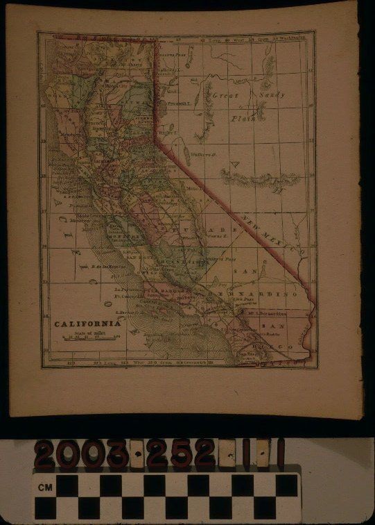
MAP OF CALIFORNIA, 1857Entry/Object ID
2003.252.1.1Description
Color: Black; Blue; Green; Orange; Yellow; Pink
A map of California, 1857. The item, which was disbound from an atlas, has the title at the bottom left, along with a scale of miles. Degrees of latitude and longitude are also provided at the edges. A red border for the state is handcolored and each county is colored in green, Yellow, red, and pink, including "Los Angelos" county in pink. Such features as cities and towns, major roads, rivers, lakes, passes, forts, waystations, islands, the missions, and county capitals in black dots, are among the notable items on the map. At the right are sections of the territories of Utah, that is, modern Nevada, and, at the lower right, a small section of New Mexico territory, encompassing southern Nevada and far western Arizona. With adhesive residue at the bottom right corner; slight warping; creases on the right; browning; minor foxing; small, light stains; and some tears from being disbound, the overall condition is good.Lexicon
Search Terms
Two-dimensional, Maps, Counties--California, California