Name/Title
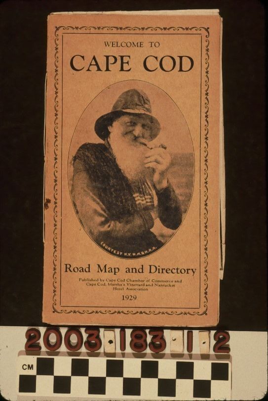
MAP OF CAPE CODEntry/Object ID
2003.183.1.2Description
Color: Black; Blue; White
A map of Cape Cod, Massachusetts, issued by the Cape Cod Chamber of Commerce and the Cape Cod, Martha's Vineyard and Nantucket Hotel Association and printed by Nichols & Eldridge, Printers, Brockton, Massachusetts, 1929. The heavier paper front cover has a floral bordered area, within which is "WELCOME TO / CAPE COD" at the top, "Road Map and Directory" at the bottom, along with the publisher's names and date, and an oval image of a white-bearded man, smoking a pipe, and giving the appearance of a fisherman. The inside front cover has a foreword, after which is a directory that is five pages, including the back cover. The map, when unfolded, shows the entire cape, with red lines denoting macadam roads, and black lines as town roads. Features such as city and town names, lakes, harbors, and bays, beaches, and other natural and human features, such as a railroad line, are provided. Steamboat lines to Martha's Vineyard, Nantucket, and Provincetown are also shown. At the upper left are lists of golf courses and hotels. At the right is a table of driving distances and lists of girls and boys summer camps. With adhesive residue on the front and back; creases; dents to the bottom corners of the cover; cover soiling; paper darkening; folds on the back cover; light stains on the back cover; staple tarnish; and small tears on the map edges and the top of the back cover, the overall condition is fair.Lexicon
Search Terms
Two-dimensional, Maps, Cape Cod Chamber of Commerce, Cape Cod, Martha's Vineyard and Nantucket Hotel Association, Nichols & Eldridge, Printers, Cape Cod (Mass.)