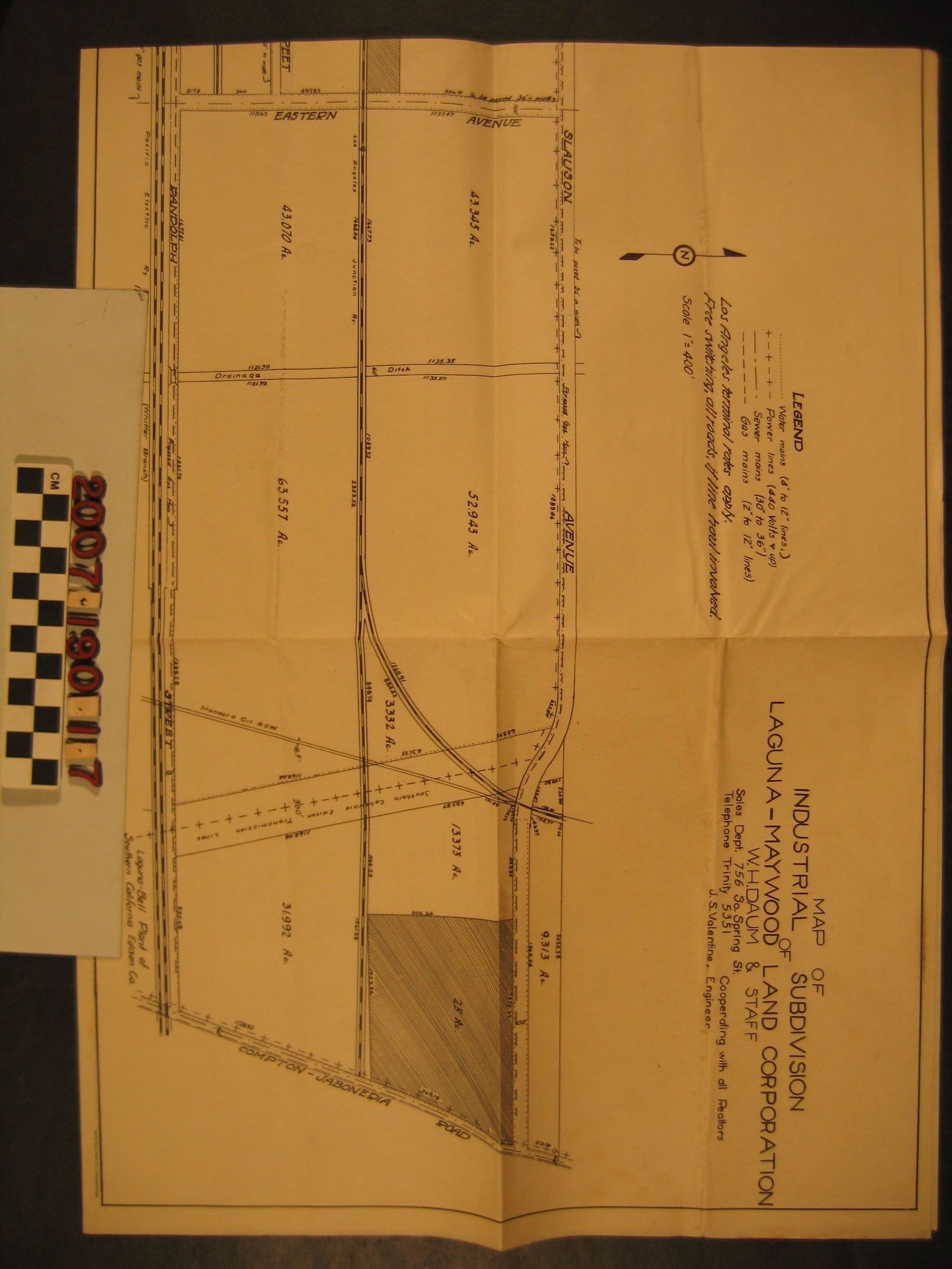
"Map of Industrial Subdivision of Laguna-Maywood Land Corporation"
Entry/Object ID
2007.190.1.7
Description
"Map of Industrial Subdivision of Laguna-Maywood Land Corporation," ca. 1920s. The map extends frm Atlantic Avenue on the west to Compton-Jaboneria Road (now Garfield Avenue) on the east and from the Los Angeles River above Fifty-Second Drive and Slauson Avenue onthe north to Randolph Street and the Union Pacific Railroad tracks to the south. Most of the tract lies in large industrial parcels between the river and Atlantic and Slauson to Randolph. There are, however, smaller lots, probably residential, on the west bank of the river along Riverside Drive (now District Boulevard.) The area covered is within the cities of Vernon, Maywood, and City of Commerce. There is an inset route map to the property at the lower left and a legent for utlities near the title at the upper right. With folds, creases, and some soiling, the condition is good.
Lexicon
Search Terms
Laguna-Maywood Land Corporation, Land subdivision--California--Maywood, Land subdivision--California--Vernon, Land subdivision--California--City of Commerce, Real estate development--California--Maywood, Real estate development--California--Vernon, Real estate development--California--City of Commerce