Color: Black; White
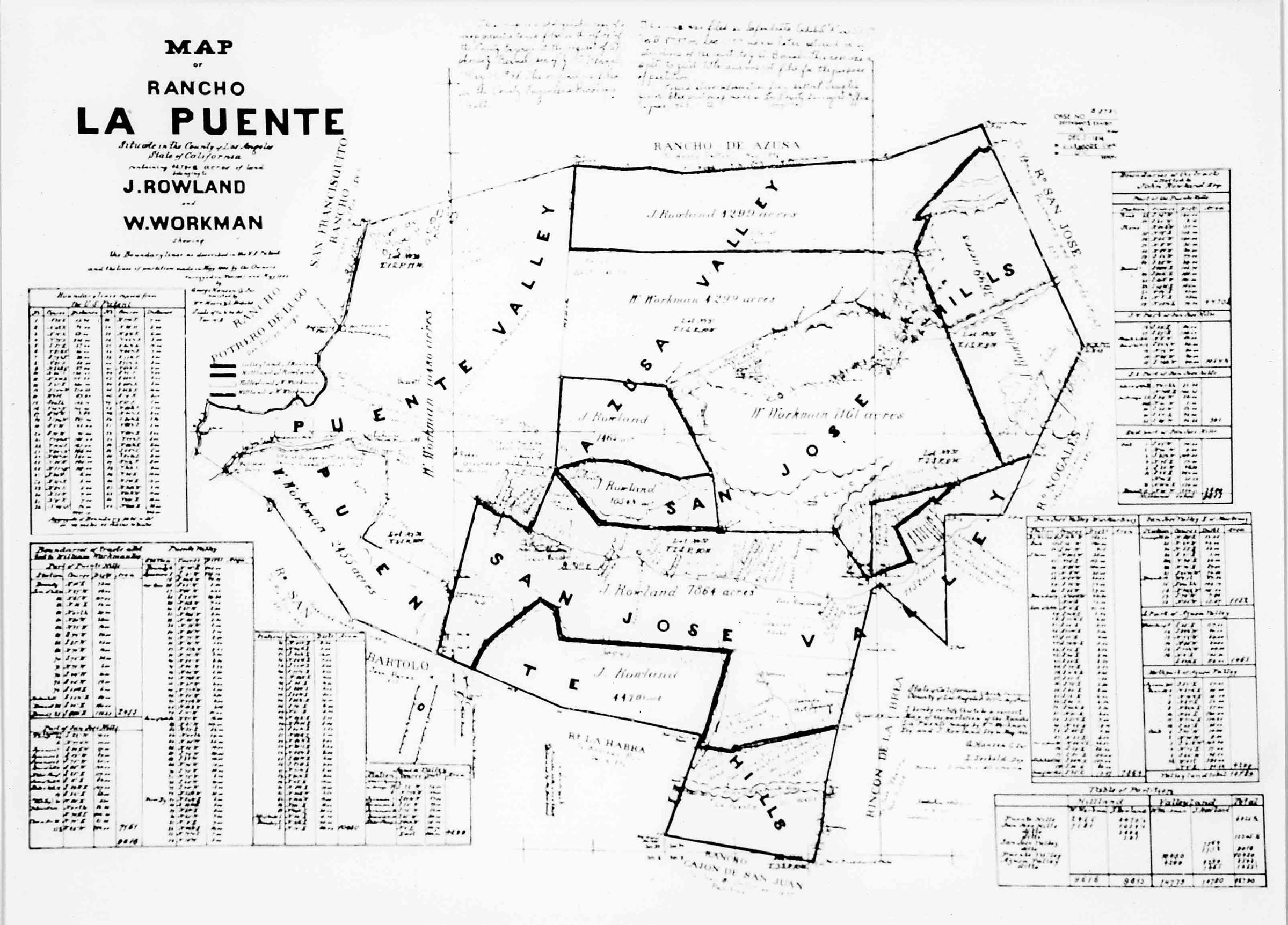
A black and white photograph, with four over-size copies and an over-size transparency, of the map of Rancho La Puente, ca. 1867. In the center is outlined the 48,790 acres of the rancho owned by John Rowland and William Workman. The land is seperated into eleven areas of various shapes and sizes with the name of either Rowland or Workman inset along with a number of acres; this indicates the owner and size of each particular parcel. Throughout different areas of the map are the names of geographical landmarks such as Puente Valley; Azusa Valley; San Jose Hills; San Jose Valley; and Puente Hills. On the far left are seven different tables with the numbers for the boundaries of the land owned by Workman, and to the right for those by Rowland. Printed on the top left corner is, "MAP/ OF/ RANCHO/ LA PUENTE/ Situated in the County of Los Angeles/ State of California/ indicating 48,790 acres of land/ belonging to/ J. Rowland/ and/ W. Workman." Other writing located below and across the top center is unligible. The map was originally created upon receiving United States titles for their properties. With no signs of wear, the image is in good condition.
Number-Units: 5
Print Size: 8"H x 10"W; 11"H x 17"W; 13"H x 17 1/2"W; 12"H x 20"W
Lexicon
Search Terms
Photographs, Maps, Historical, Maps--Reproduction, Ranches--Los Angeles County (Calif.)