Name/Title
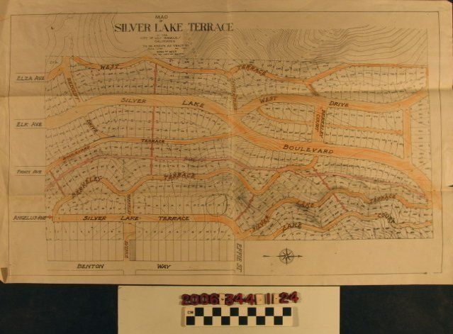
"Map of Silver Lake Terrace in the City of Los Angeles, California"Entry/Object ID
2006.344.1.24Description
"Map of Silver Lake Terrace in the City of Los Angeles, California," drawn by Morin and Meier, November 1922. The map covers an area bounded by West Terrace (now Westerly Terrace) on the west, Benton Way on the east, north of Scott Place to the south, and Silver Lake Boulevard, where it meets Easterly Terrace and Fanning Street on the north. There are lot numbers, measurements of depth and width, geographic contours and indications of heights above sea level, and scale, date, and the draftsmen's names. Thoroughfares within the tract are colored orange, with community walkways in red. Lots 26-27 are circled with pencil and there are some pencil math calculations on the reverse. With original folds, some staining and soiling, creases, and dog-eared corners, the condition overall is good.Lexicon
Search Terms
Morin and Meier [firm], Real estate subdivisions--California--Los Angeles, Residential neighborhoods--California--Los Angeles