Name/Title
MAP OF THE CITY OF INDUSTRY CIVIC-FINANCIAL CENTEREntry/Object ID
2001.6.1.6Description
MAP OF THE CITY OF INDUSTRY CIVIC-FINANCIAL CENTER
Color: Black; White
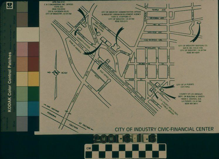
A map of the City of Industry Civic-Financial Center, ca. 1990. Printed on copy paper, the black and white colored map shows the center at the center left, basically from Hudson Avenue on the west to Glendora Avenue on the east and from Nelson Avenue on the north to the Southern Pacific Railroad tracks to the south. Several sites of significance are highlighted with arrows and text giving contact information, including the city hall, post office, Bank of America, First Federal Savings and Loan, the Los Angeles County Sheriff's Station, and the Industry Manufacturer's Council. At the right is downtown La Puente, with three areas highlighted there, including the county departments of Building and Safety and health, the county library branch, and the La Puente City Hall. At the upper right is more of the La Puente area, with the highlighting of the City of Industry Disposal Company and its contact information. At the lower left is Hacienda Boulevard as the connector to the civic-financial center from the Pomona Freeway (60.) A directional indicator, with the indicator "NO SCALE" is at the left and the district name is at the bottom right. Other than a crease or two, there is no significant wear or damage, and the artifact is in good condition.Lexicon
Search Terms
Two-dimensional, Maps, Maps--City of Industry (Calif.), Civic centers--City of Industry (Calif.), Central business districts--City of Industry (Calif.)