Name/Title
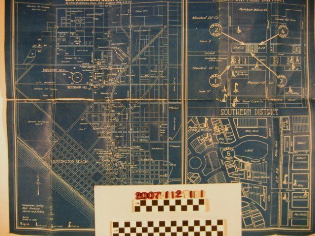
Map of the Huntington Beach Oil FieldEntry/Object ID
2007.112.1.1Description
Map of the Huntington Beach Oil Field, by Uhler and Andrews, published by Hunsaker & Woodmancy, Los Angeles, 9 June 1921. The map, which is on blue paper, shows the field, the names of oil companies operating there; the location of wells; whether the wells have a rig in place, are drilling, or are producing; a list of the number of companies drilling, producing wells, and derricks up and building; and other information. At the right are enlarged sections, corresponding to circled areas on the general map, of the holdings of the Pico Petroleum Company at the Reservoir Hill District and Southern District. With folds, many creases, edge tears, dogeared corners, and tape along the horizontal center fold, the condition is fair.Lexicon
Search Terms
Hunsaker and Woodmancy [firm], Pico Petroleum Company, Uhler and Andrews [firm], Oil fields--California--Huntington Beach, Petroleum prospecting--California--Huntington Beach