Name/Title
MAP OF THE LA PUENTE HOMESTEAD PROPERTY, 1880-81Entry/Object ID
2001.208.1.4Description
MAP OF THE LA PUENTE HOMESTEAD PROPERTY, 1880-81
Color: Black; White
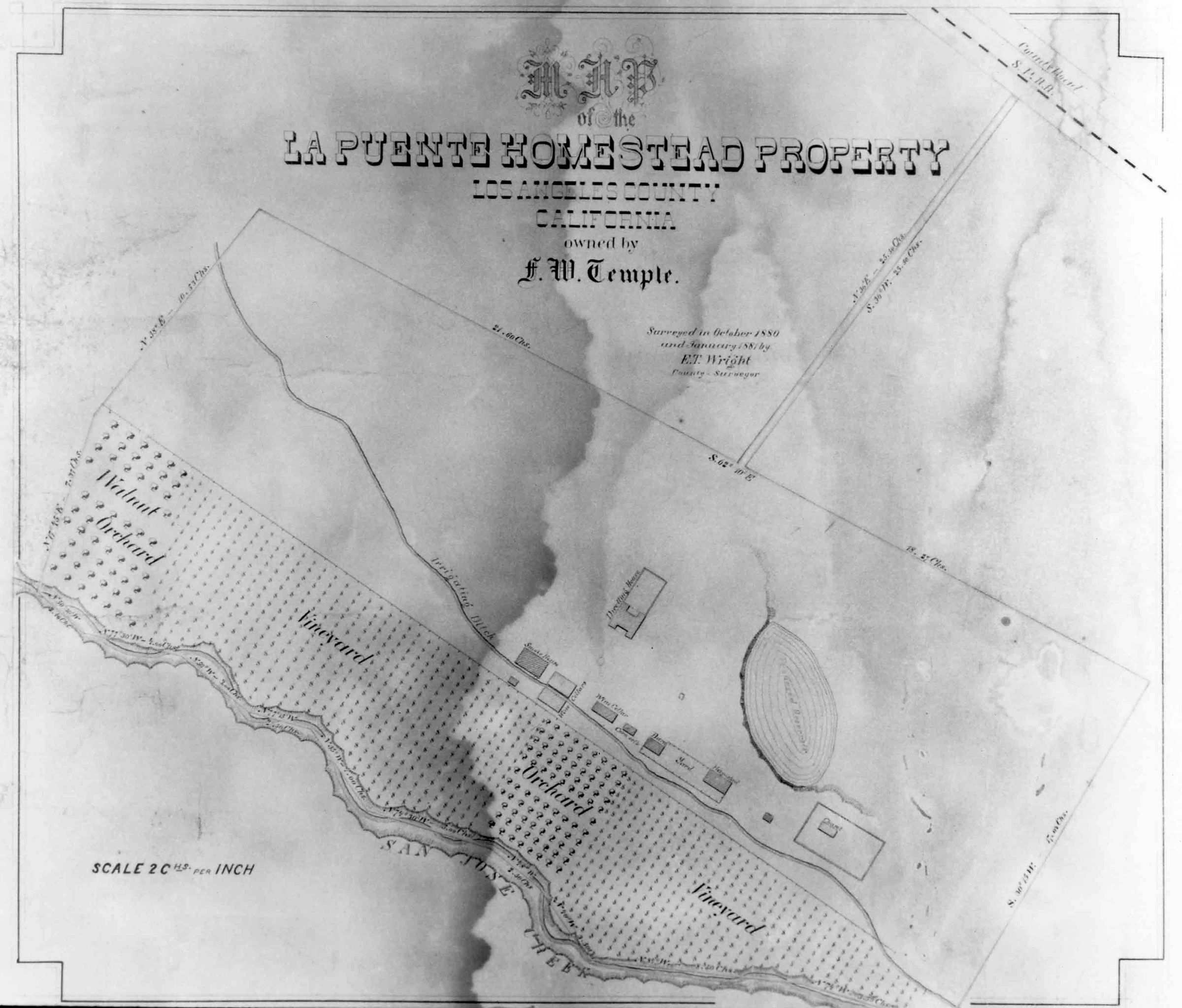
A photograph of a map titled "Map of the La Puente Homestead Property," 1880-81. The map, commissioned by Francis W. Temple and drawn by Los Angeles County Surveyor E. T. Wright, has the title at the top, with the owner's name below and the dates of the survey and surveyor's name, below and to the right. The survey is of the seventy-five acre parcel, sold by Lucky Baldwin's agent, William Alvord to Temple in October 1880. Boundary lines with measurements in chains enclose the property. At the bottom is San Jose Creek and bisecting the Homestead is an irrigating ditch. Between these are denoted sections of vineyards, an orchard, and a walnut orchard. A series of buildings includes the Workman House, identified as "Dwelling House" with an enclosure on the north side, the adobe smoke house below and to the left, three wine cellars to the right of the smokehouse, a corn crib to the right of a wine cellar, and a fenced yard, with a barn and hay shed within it to the right of the corn crib. Further right is the cemetery, with the chapel denoted within it. Above this is an indicated "Proposed Reservoir. Two other small unidentified structures, once below the smoke house, and one between the hay shed and cemetery, are also shown. Toward the upper right is an access road leading northeast to the "County Road," now Valley Boulevard. At the lower left is the legend showing the scale of chains per inch. As a new reproduction, the photograph is in mint condition.
Number-Units: 1Lexicon
LOC Thesaurus for Graphic Materials
Maps, Outbuildings, WalnutsSearch Terms
Two-dimensional, Photographs, Ranches--Los Angeles County (Calif.), Adobe houses--City of Industry (Calif.), Dwellings--City of Industry (Calif.), Cemeteries--City of Industry (Calif.), Chapels--City of Industry (Calif.), Vineyards--Los Angeles (Calif.), Orchards--Los Angeles County (Calif.)