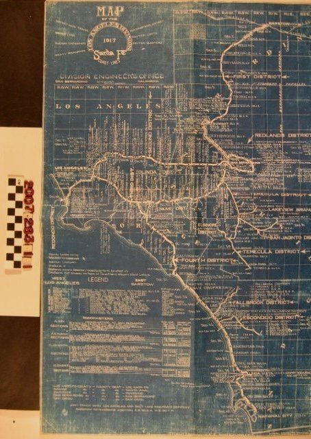
"Map of the Los Angeles Division, Santa Fe Coast Lines, 1917"
Entry/Object ID
2007.283.1.1
Description
"Map of the Los Angeles Division, Santa Fe Coast Lines, 1917," issued by Division Engineer's Office, San Bernardino from a 8 June 1917 drawing corrected to 12 February 1918. The blueprint map shows company lines extending from Barstow on the north to National City on the south and from Los Angeles on the west to San Bernardino, Hemet, and Temecula on the east. Thick white lines denote company lines, stops are listed with distances. Township and section indications are included and there is a legend and list of road masters. With edge wear, fading, and creases, the condition is generally fair.
Lexicon
Search Terms
Atchison, Topeka and Santa Fe Railroad. Los Angeles Division.