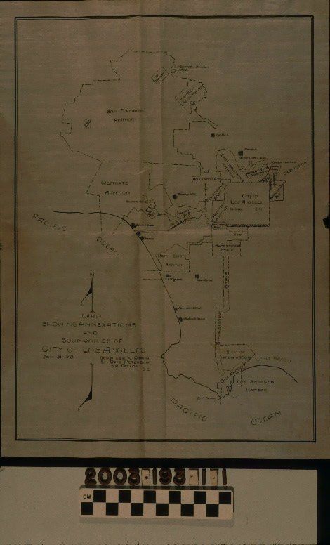
"MAP SHOWING ANNEXATIONS AND BOUNDARIES OF CITY OF LOS ANGELES"
Entry/Object ID
2003.193.1.1
Description
"MAP SHOWING ANNEXATIONS AND BOUNDARIES OF CITY OF LOS ANGELES"
Color: Black; White
A map titled "Map Showing Annexations and Boundaries of City of Los Angeles," compiled and drawn by Dave Peterson and S. A. Taylor, 31 January 1918. The onion skin map has the entire city boundary with sections in dotted boundary lines denoting the original city boundary and the many additions and annexations to date. These latter are identified by name. Also included, with a grid-like symbol with the name adjacent are incorporated cities situated around Los Angeles. Other features include Los Angeles Harbor, Point Fermin, and the Pacific Ocean. At the lower left is the title, date, author's names and a compass. With folds; a loss at the center of the right edge; minor brittleness; creases; light soiling; ; some discoloration; and right edge tears, the condition is fair.
Lexicon
Search Terms
Two-dimensional, Maps, Annexation (Municipal government)--Los Angeles (Calif.), Cities and towns--Growth