Name/Title
"MAP SHOWING THE DISTRIBUTION OF THE INDAN [SIC] TRIBES OF CALIFORNIA"Entry/Object ID
2003.208.1.1Description
"MAP SHOWING THE DISTRIBUTION OF THE INDAN [SIC] TRIBES OF CALIFORNIA"
Color: Black; Brown; Gray; Green; White; Yellow
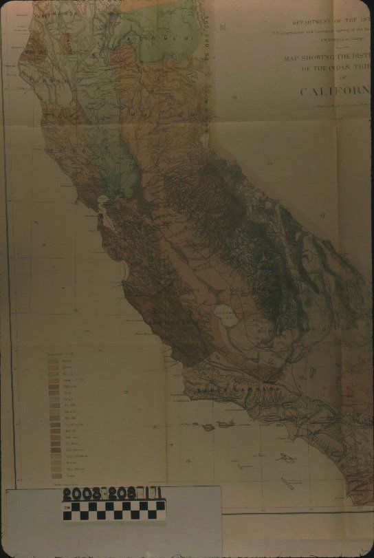
"Map Showing the Distribution of the Indan [sic] Tribes of California," from the United States Department of the Interior, United States Geographical and Geological Survey, John Wesley Powell in charge, illustrating a report by Stephen Powers, 1877. The map is based on a Rocky Mountain map by the U. S. G. S. and has typical geograhical and geological features (marks for latitude and longitude, cities, towns, and communities; rivers and lakes; mountains; railroad lines and so forth.) Colors in various shades of brown, gray, green, and yellow indicate linguistically-described groups in the state, including "Sho-Sho-Ni" for the greater Los Angeles area from San Luis Rey Mission on the south to San Fernando in the north to San Bernardino on the east and as far north as just south of Lake Tahoe. A legend of these "linguistic stocks" is at the lower left, along with the indicator of tribal boundaries (a dotted line) and a scale of miles. The title, agency and individual names, and the date are at the upper right. With archival tape on the back at the folds, light creases, minor yellowing, the original folds, and a few small tears, the overall condition is good.Lexicon
Search Terms
Two-dimensional, Maps, United States. Department of the Interior, United States Geographical and Geological Survey, Indians of North America--California, Indians of North America--California--Maps