Name/Title
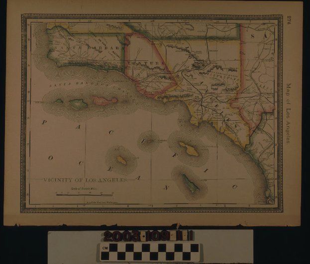
MAP, "VICINITY OF LOS ANGELES," 1885Entry/Object ID
2003.109.1.1Description
Color: Green; Red; Wehite; Yellow
A map of "Vicinity of Los Angeles," 1885. The item, page 274 of a book, is a color rendering that includes the entirety of the counties of Los Anglees, Ventura, and Santa Barbara and portions of those of Kern, San Bernardino, and San Diego--the borders being distinguished by red, green, and yellow colors. Such features as cities and towns; railroad lines; main roads; rivers and creeks; hill and mountain chains; and some indication as to industries in areas, such as mining and oil, are included. Offshore islands are in the aforementioned colors and wavy lines indicate coasts of the mainland and islands. The title and a mile scale are at the bottom left. The borders have letters and numbers for reference points. At the right is the page number and "Map of Los Angeles." With edge browning, holes where the book binding was, some creases, small tears, and minor soiling, the overall condition is good.Lexicon
Search Terms
Two-dimensional, Maps, Los Angeles (Calif.), California, Southern, Los Angeles County (Calif.), Ventura County (Calif.), Santa Barbara County (Calif.)