Name/Title
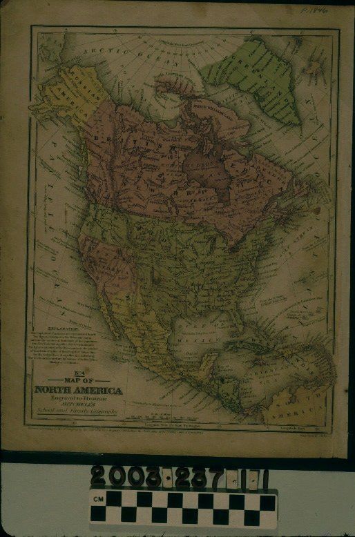
MITCHELL'S MAP OF NORTH AMERICA, NO. 4, 1846Entry/Object ID
2003.237.1.1Description
Color: Black; Green; Pink; Yellow; White
Mitchell's "Map of North America, No. 4," published by S. Augustus Mitchell, 1846. The map shows the entirety of northern and central America with colors of pink, green, and yellow denoting countries. The United States is not divided into states, which is the same case for Mexico. Curiously, "Upper California" is a separate color than both the United States and Mexico and includes that area of Mexico conquered by the United States and ceded by Mexico in the subsequent war between those two countries. This includes modern California, Nevada, Utah, Arizona, and portions of Colorado and New Mexico. Features include cities, rivers, mountain ranges, oceans, islands, Indian tribal areas, and others. At the edges are parallel markings and there are distances from the United States and California to various world locations in miles at several areas. At the bottom left is the title and an explanation of how capitals are denoted and that numbers next to cities is for population, and next to rivers for miles in length, as well as noting Indian tribes and missionary stations. A scale of miles is at the bottom center. The name of the engraver, J. H. Young, is at the bottom right. At the upper right is the date in pencil. With brittleness; creases at the corners and edges; light soiling; browning; foxing; a small loss at the bottom left corner; pin holes at the bottom right; stains; and small edge tears, the condition is fair.Lexicon
Search Terms
Two-dimensional, Maps, North America, California