Name/Title
MITCHELL'S MAP OF OREGON AND UPPER CALIFORNIA, NOS. 15-16, 1846Entry/Object ID
2003.262.1.1Description
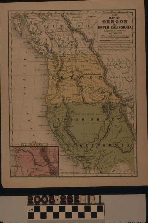
MITCHELL'S MAP OF OREGON AND UPPER CALIFORNIA, NOS. 15-16, 1846
Color: Black; Green; Pink; Yellow; White
Mitchell's "Map of Oregon and Upper California, Nos. 15-16," published by S. Augustus Mitchell, 1846. The map shows the area from British America [Columbia] on the north to the border of Mexico (though not the current border) on the south and from the Pacific Ocean on the west to the Missouri Territory (that is, the Rocky Mountains, roughtly) on the east. Oregon, which also includes Washington and most or all of Idaho is shown in yellow and "Upper or New California," extending through Nevada, Utah and parts of New Mexico and Colorado, is in green. At the bottom right is a small inset of map #16 embracing the area in and around the Columbia River and this is in red. At the upper right is the title, a scale of miles, and notes on the determination of the Oregon territory boundaries per a new treaty of 1846. Typical features, such as towns, settlements, forts, and missions; rivers and lakes; mountain ranges; roads and trails; the names of Indian tribes; boundary lines with treaty dates for reference; and islands are among those of note. At the bottom left is a note about Mitchell's recording of the map with the Library of Congress. With small creases at the top corners; browning; some foxing; a loss at the bottom left corner; and a large stain on the back, the condition is good.Lexicon
Search Terms
Two-dimensional, Maps, North America, California, Oregon