Name/Title
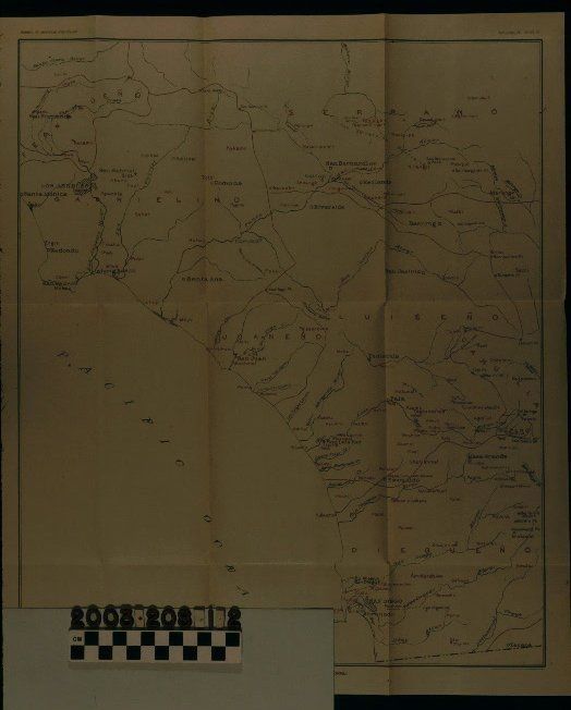
"NATIVE SITES IN PART OF SOUTHERN CALIFORNIA"Entry/Object ID
2003.208.1.2Description
Color: Black; Red; White
"Native Sites in Part of Southern California," a map issued by the Bureau of Ethnology and engraved and printed by the U. S. Geological Survey, 1925. The item came from a Bureau of Ethnology bulletin, the number of which, along with the plate number of the map, is at the upper right. The title is at the bottom center. The area covered in the map extends from the U. S. - Mexico border on the south to San Fernando on the north to the Palm Springs area south to Tecate. Red lines indicate boundaries of several tribal groups, the names of which are in each jurisdiction, including the Gabrielino for the general Los Angeles area. Place names are also indicated in red and include "Awi" or Awig-na, the village in the La Puente area and "Hout" which appears to be the old San Gabriel Mission area. Other features include cities and towns, rivers, mountains and ranges, and others. On the back upper left is a pencil inscription of the date "1925." With some archival tape on the back, yellowing of the paper, and original folds, the overall condition is good.Lexicon
Search Terms
Two-dimensional, Maps, United States Geographical and Geological Survey, United States. Bureau of American Ethnology, Indians of North America--California, Southern, Indians of North America--California, Southern--Maps