Name/Title
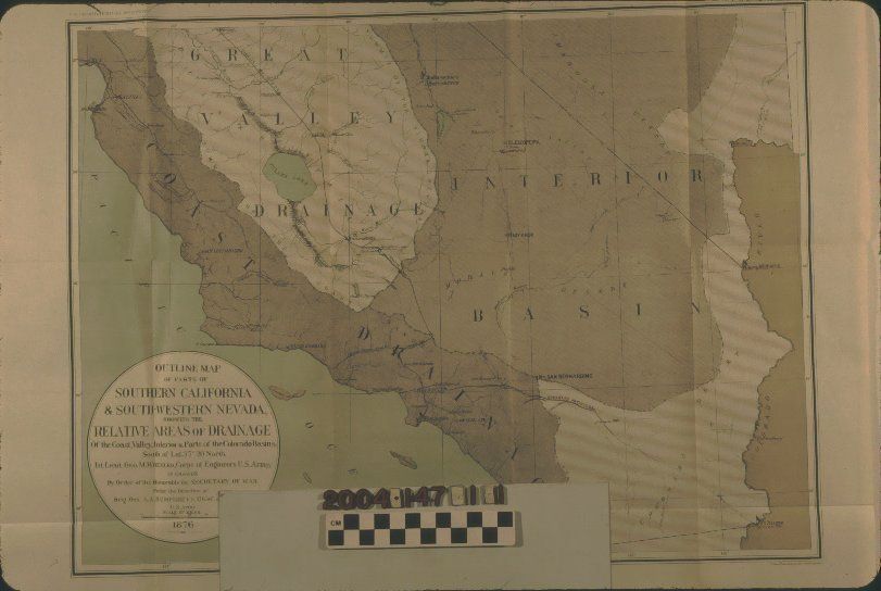
"OUTLINE MAP OF PARTS OF SOUTHERN CALIFORNIA & SOUTH-WESTERN NEVADA SHOWING THE RELATIVE AREAS OF DRAINAGE OF THE COAST AREA, INTERIOR & PARTSEntry/Object ID
2004.147.1.1Description
"OUTLINE MAP OF PARTS OF SOUTHERN CALIFORNIA & SOUTH-WESTERN NEVADA SHOWING THE RELATIVE AREAS OF DRAINAGE OF THE COAST AREA, INTERIOR & PARTS
Color: Black; Brown; Green; White
"Outline Map of Parts of Southern California & South-Western Nevada Showing the Relative Areas of Drainage of the Coast Valley, Interior & Parts of the Colorado Basins," under the direction of Brig. Gen. A. A. Humphreys and from a party led by 1st. Lieut. George M. Wheeler, United States War Department, 1876. The map shows the region from Santa Cruz in the north to San Diego on the south to the Virgin River area east of Las Vegas on the east. Dotted lines demarcate the drainage areas identified as the Coast Drainage, Great Valley Drainage, and Interior Basin. There is a fourth area without a name on the map, but noted as "The Colorado in California" in a box at the bottom giving the relative areas of drainage in approximate square miles. The title, list of officials, scale of miles, and date, are within a circular border at the lower left. Other notable features of the map include cities and towns, rivers, railroad lines, mountains, lakes, some islands, and passes. In good overall condition, the item has adhesive tape for repairs on folds; some creases at folds; very light surface soiling; yellowing; original folds; stamps on the back; light handling stains on the back; and several tears on folds.Lexicon
Search Terms
Two-dimensional, Maps, United States. War Department, Geological surveys--California, Drainage--California, Subsurface drainage--California, Surveys--California