Name/Title
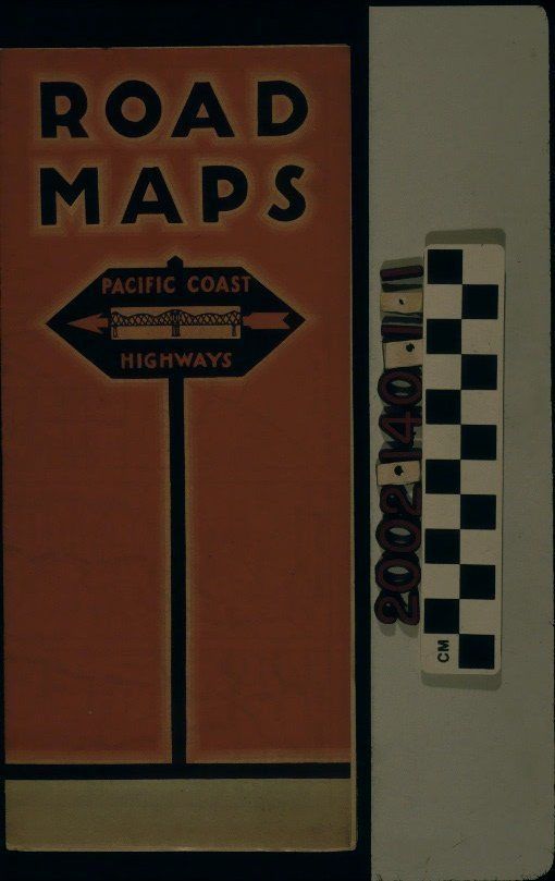
PACIFIC COAST HIGHWAYS ROAD MAP, 1928Entry/Object ID
2002.140.1.1Description
Color: Black; Gray; Orange
A road map of Pacific Coast highways, issued by The American Toll Bridge Company, San Francisco, 1928. The front cover has the words "ROAD / MAPS" at the top in black letters. Below this is an image of a roadside sign with the words "PACIFIC COAST / HIGHWAYS" in orange letters and a logo of an arrow and a bridge. At the bottom is the publisher's name and address. Stamped at the right of center is the name of a travel information service. The back cover is identical to the front, but without the publisher's information. When opened one fold a mileage chart of various cities and places in the three coastal states, California, Oregon, and Washington is revealed. Opening another fold shows shows small maps of eight segments of the coastal road system from San Diego to Vancouver, British Columbia, Canada. When the map is fully opened, there are two other segment maps; smaller maps of the downtown areas of San Jose, Oakland, San Francisco, and Sacramento; a detail of the San Francisco Bay region; and highway maps of California, Oregon, and Washington. At the bottom right are photos and information of two bridges in the Bay Area, presumably those connected with the publisher. With some corner dents, light soiling, slight yellowing, and minor wear, the map is in good condition.Lexicon
Search Terms
Three-dimensional, Maps, The American Toll Bridge Company, Highways--California, Highways--Oregon, Highways--Washington