Name/Title
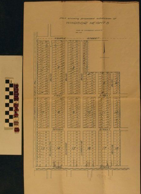
"Plat Showing Proposed Subdivision of Windsor Heights"Entry/Object ID
2006.344.1.8Description
"Plat Showing Proposed Subdivision of Windsor Heights," prepared by the Engineering Service Company, December 1919. The map reflects a portion of the original 200 acre Windsor Square subdivision from 1911 and onward, of which maps .2-.7 reflect, that was sold off after World War I, for the new "Windsor Heights", eventually renamed "New Windsor Square", subdivision. It shows eighteen blocks with individually-numbered lots within each and also, in most cases,2 providing lot sizes in feet for depth, and prices. The area shown is from Temple Street (now Beverly Boulevard) on the north to Third Street on the south and from Larchmont Boulevard on the west to east of Lorraine Boulevard on the east. This early draft consists of much smaller lots on straight, linear streets than what was adopted, as seen on items .6-.8. With original folds, creases and some edge wear, including small tears, the general condition is fair.Lexicon
Search Terms
Engineering Service Company, Real estate subdivisions--California--Los Angeles, Residential neighborhoods--California--Los Angeles