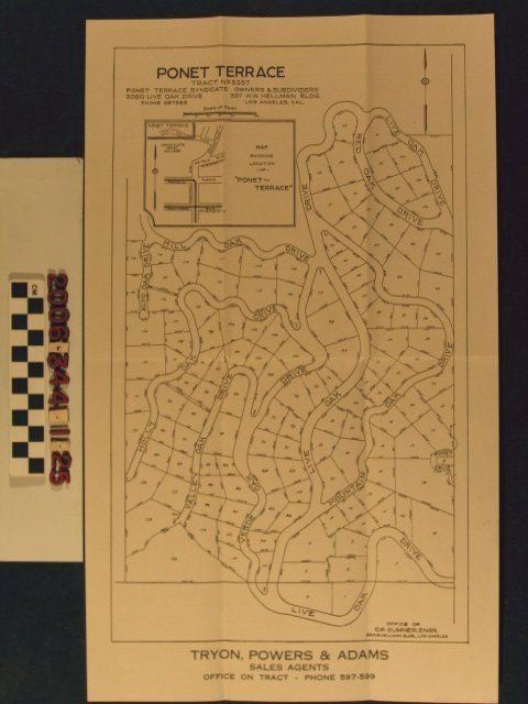
Name/Title
"Ponet Terrace, Tract No. 5257"Entry/Object ID
2006.344.1.25Description
"Ponet Terrace, Tract No. 5257," drawn by C.R. Sumner and published by Ponet Terrace Syndicate, 1920s. The map covers an area bounded by Live Oak Drive to the south, Hill Oak Drive and Live Oak Drive to the north, Holly Oak and Alto Oak drives to the west, and Ponet Drive to the east, northwest of the intersection of Western Avenue and Los Feliz Boulevard, near Griffith Park. There are lot numbers, measurements of depth and width, a nearby location map, and information on the owners, engineer, and sales agents. With original folds and one slight area of staining at the right margin, the condition overall is good.Lexicon
Search Terms
Ponet Terrace Syndicate, Tryon, Powers & Adams, Real estate subdivisions--California--Los Angeles, Residential neighborhoods--California--Los Angeles