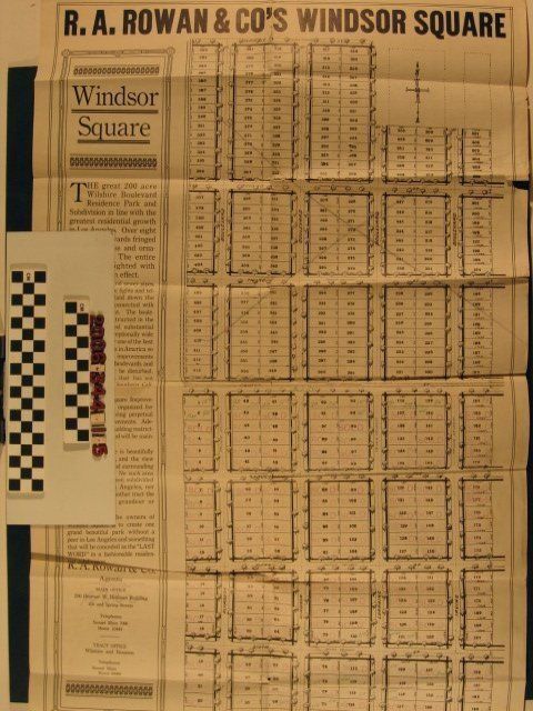
"R.A. Rowan and Co.'s Windsor Square," ca. 1915. The map shows a 200-acre area bordered by Temple Street (now Beverly Boulevard) on the north to Third Street on the south and from just west of Plymouth Avenue on the west to east of Irving Boulevard on the east. This map consists of lots arranged on straight, linear streets and was issued before the portion north of Third Street was sold and separately subdivided as New Windsor Square (see later maps in the accession). In fact, this area of the map is crossed out to reflect the sale of that property. There is some text about the project and contact information for the Rowan Company. This edition differs from item .2-4 in that it has further indications of sold lots, and reflected the renaming of Third and Fourth streets With original folds, including some tears, some significant creases and some edge wear, including small tears and the lower left corner missing, the general condition is fair.
Lexicon
Search Terms
R.A. Rowan and Company, Real estate subdivisions--California--Los Angeles, Residential neighborhoods--California--Los Angeles