Name/Title
"RECONNAISSANCE OF CATALINA HARBOR"Entry/Object ID
2004.63.1.2Description
Color: Black; White
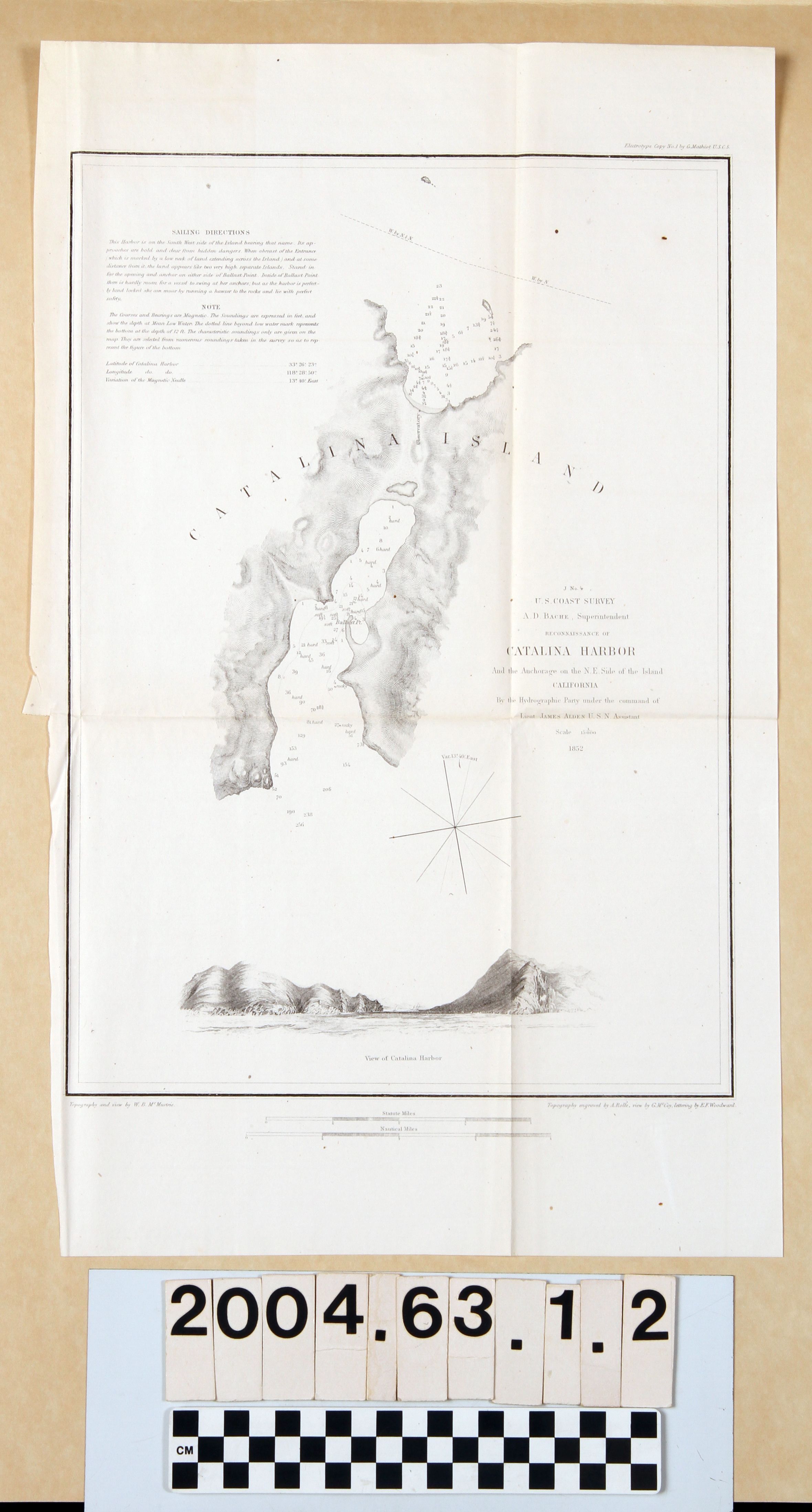
Map, "Reconnaissance of Catalina Harbor [J No. 4]," U. S. Coast Survey, United States Navy, 1852. The map was conducted under the auspices of superintendent A. D. Bache under the command of naval officer James Alden. The map shows the isthmus area of the island with topographical details, notations of bottoms, and soundings, as well as occasional inland references, such as the "Observatory" on the northern side of the isthmus. The harbor is indicated as being on the southern side. At the upper left are sailing directions, notes, and the positions of longitude, latitude, and variations of the magnetic needle. At the right of center is the title, date, and the compass is below that to the left. A view of the harbor is at the bottom, below which are scales for statute and naturical miles. Artists' credits are at the bottom left and right, as well as at the top right. With yellowing, original folds, minor foxing, and tears at the left center edge, the overall condition is good.Lexicon
LOC Thesaurus for Graphic Materials
AnchorageSearch Terms
Two-dimensional, Maps, United States. Navy, United States Coast Survey, Harbors--Anchorage--Santa Catalina Island (Calif.), Surveys--Plotting, Topographical drawing--California, Topographical surveying--California