Name/Title
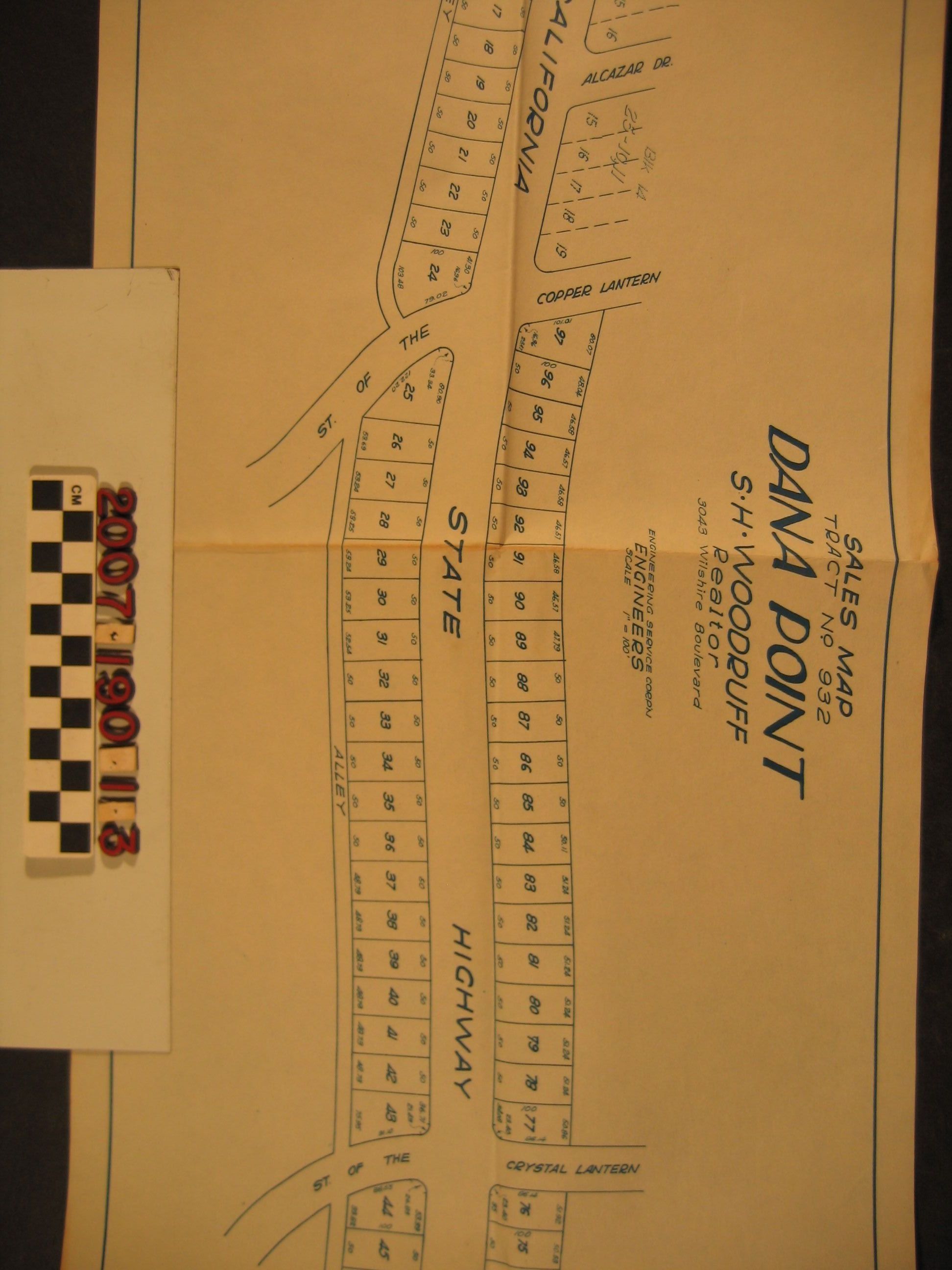
"Sales Map, Tract No. 932, Dana Point"Entry/Object ID
2007.190.1.3Description
"Sales Map, Tract No. 932, Dana Point," by Engineering Service Corporation and marked by Sidney H. Woodruff, Los Angeles, ca. 1926. The map shows the tract along "California State Highway," now Pacific Coast Highway, California State Route 1. There are ninety-seven lots shown, most averaging 50' by 50'. The boundaries run from Street of the Golden Lantern to McKinley Avenue, with an alley running along the south side of the tract. There are some references to adjoining tracts to the west. With folds, browning along these, a small tear or two on the edge and some soiling, the condition is good.Lexicon
Search Terms
Dana Point Syndicate, Land subdivision--California--Dana Point, Real estate development--California--Dana Point