Name/Title
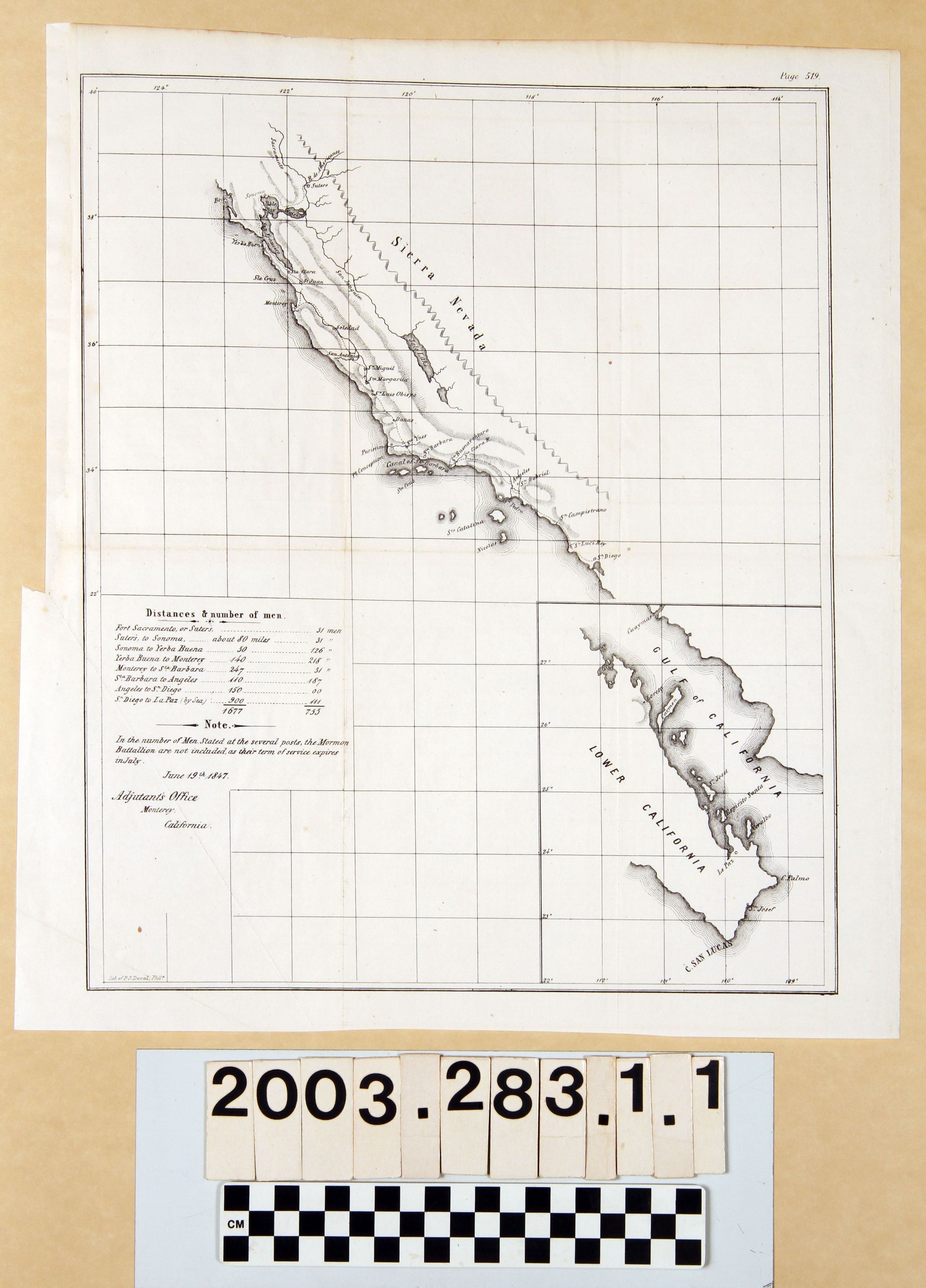
SKETCH OF CALIFORNIA COAST FROM BODEGA BAY TO SAN DIEGO AND PART OF BAJA CALIOFRNIA, JUNE 1847Entry/Object ID
2003.283.1.1Description
SKETCH OF CALIFORNIA COAST FROM BODEGA BAY TO SAN DIEGO AND PART OF BAJA CALIOFRNIA, JUNE 1847
Color: Black; White
A lithograph by P. S. Duval of Philadelphia of a map showing the California coast from Bodega Bay in the north to San Diego in the south, with an inset of the tip of Baja California, dated June 19, 1847. The map was drawn to show placements of military personnel from the United States in the securing of California and Baja California after the conquest of these areas in the Mexican-American War. Major place names, including towns and the missions, as well as roads, mountains, lakes and rivers, islands, and others are noted, although very little of the interior is shown. At the bottom right is the inset showing the southern tip of the Baja peninsula, but only the towns of Loreto and La Paz are demarcated. At the lower left is a table showing regions, distances in these regions, and the number of men stationed, totaling 755 soldiers in an area 1,677 miles in length. An explanatory note is that the Mormon Battalion of soldiers is not included because their service expired in July. There is also a date and a note that the map came from the Adjutant's Office in Monterey. At the bottom left corner is the name of the lithographer. With light corner creases; minor soiling; slight yellowing; folds; light foxing; and small edge tears, the overall condition is good.Lexicon
Search Terms
Two-dimensional, Maps, United States. Army, Armed forces--California, Command of troops--California, Military camps--California, Mexican War, 1846-1848--California