Name/Title
SOIL MAP, SAN GABRIEL SHEETEntry/Object ID
2001.116.1.1Description
Color: Blue; Brown; Orange; Yellow; White
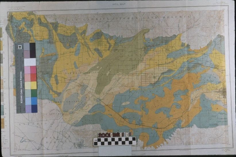
A soil map of the San Gabriel Valley, surveyed by J. Garnett Holmes and Louis Mesmer and produced by the Bureau of Soils, United States Department of Agriculture, 1901 from a 1900 base map by the U. S. Geological Survey. The map covers the area from Pasadena on the west to Pomona on the east and from the San Gabriel Mountains on the north to Whittier and the Puente Hills on the south. The names of the Spanish and Mexican-era ranchos and their boundaries are on the map, with La Puente at a little right and below center. Cities and towns are also indicated, as are train station stops. Sections of land, indicated by the township delineators are clearly visible, as well. Colors are used to indicate the types of soils, which are encompassed in a legend at the far right margin. These colors include shades of blues, browns, orange, and yellow and demarcate river wash, sand, loam, adobe, and gravel soil types. At the bottom margin are scale indicators, as well as dates of the map's creation, the publisher, and the names of the surveyors. At the left margin is a legend of eight soil profiles and another of the alpha character symbols for the soil types. The artifact is in good condition with fold lines, a few creases, and a small 1/2" tear at the upper left, second vertical fold.Lexicon
Search Terms
Two-dimensional, Maps, U. S. Department of Agriculture. Bureau of Soils, A. Hoen and Co., Maps--San Gabriel River Valley (Calif.), Soils--Maps--San Gabriel River Valley (Calif.), San Gabriel River Valley (Calif.)--History