Name/Title
SOUTHWEST PART OF RANCHO LA PUENTE, 1870Entry/Object ID
2001.208.1.1Description
Color: Black; White
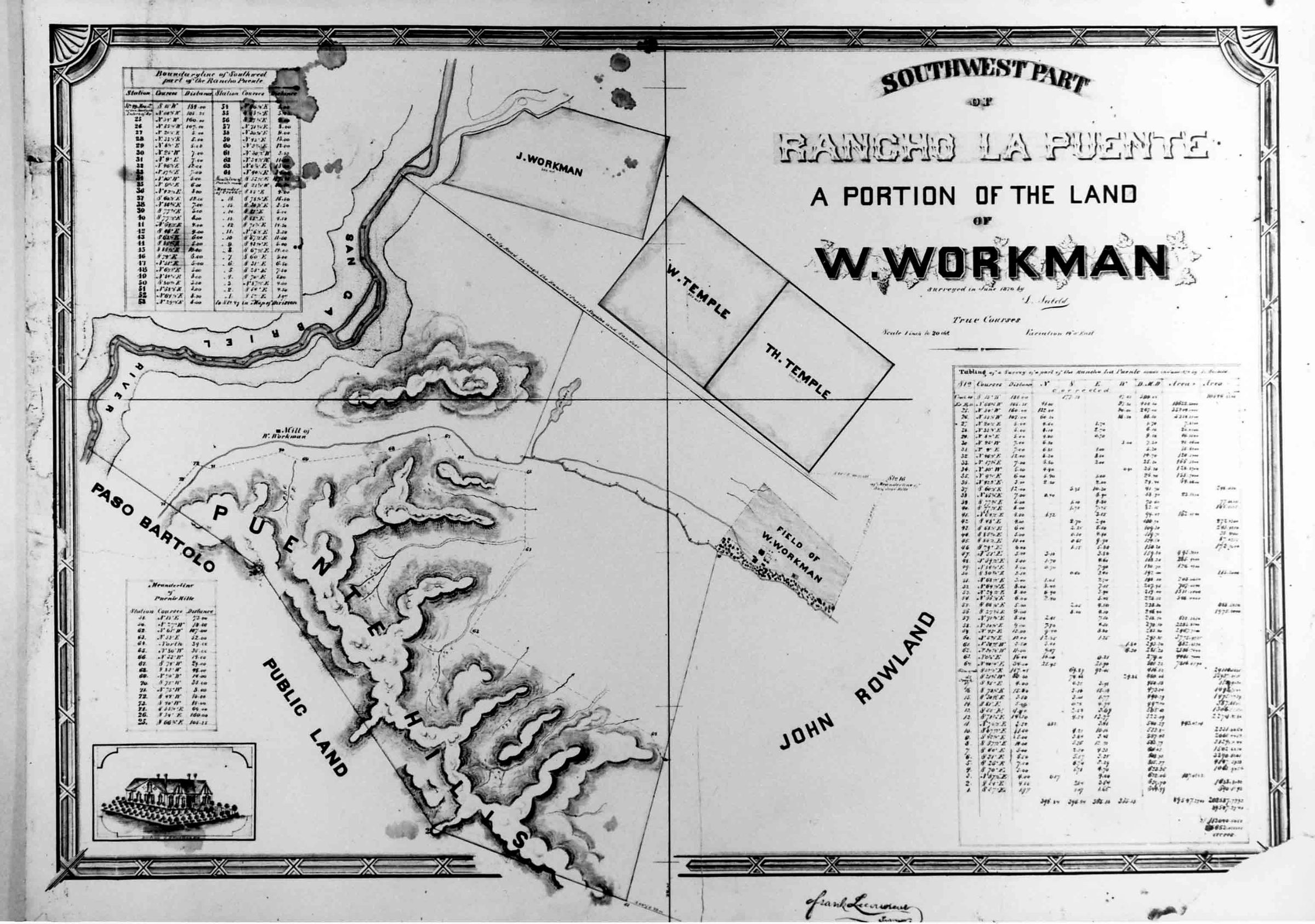
A photograph of a map of "Southwest Part of Rancho La Puente, A Portion of the Land of W. Workman," surveyed in June 1870 by Los Angeles County Assistant Surveyor Lothar Seebold. The map had an ornate border and the lettering for the title is at the upper right with the date of the surveyor, his name, and information on scale and variation. Below this is one of three charts, this concerning the tabling of survey details. A second chart is at the upper left and includes boundary line information and a third chart at the lower left shows meander line information. Below this last chart is a drawing of the Workman House, the earliest image extant of the remodeled structure. The map shows that portion of the rancho from the Workman house and field, south to the border in the Puente Hills, west to the San Gabriel River, and north to parcels set aside for Workman's son, Joseph, and grandsons, William and Thomas Temple. Other landmarks, include what is now Valley Boulevard, San Jose Creek, a small lake west ofm the Workman House, low-lying hills, and the Workman Mill. The Workman House area shows the outlines of the home, wineries, cemetery and chapel, and other outbuildings. To the right of this is an indication of where John Rowland's property begins east of Workman's holdings. Below the lower border is the signature of County Surveyor Frank Lecouvreur. There are several areas at the top and top left showing stains on the original. As a reproduced photo, this artifact is in mint condition.
Number-Units: 1Lexicon
LOC Thesaurus for Graphic Materials
MapsSearch Terms
Two-dimensional, Photographs, Ranches--Los Angeles County (Calif.), Dwellings--City of Industry (Calif.), Adobe houses--City of Industry (Calif.)