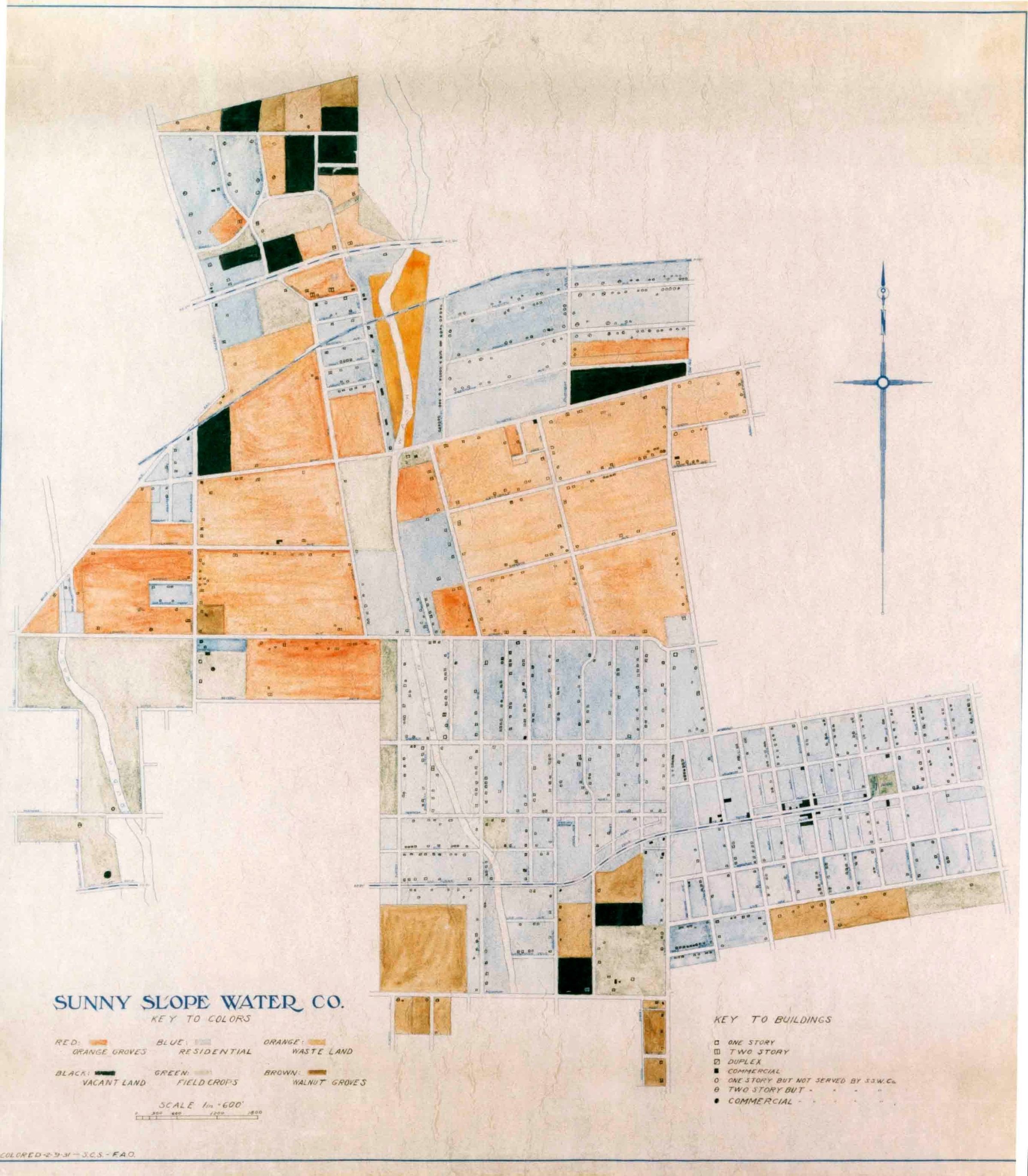
SUNNY SLOPE WATER COMPANY SERVICE AREA DETAIL MAP, CA. 1931
Entry/Object ID
95.2.1.2
Description
SUNNY SLOPE WATER COMPANY SERVICE AREA DETAIL MAP, CA. 1931
A color reproduction photograph of a service area detail map for the Sunny Slope Water Company, 1931. The map included the original and subsequently added areas, as indicated in photo 95.2.1. Areas are colored with a legend at lower left indicating what type of land use is matched to a color. At lower right is the 263-acre Temple Townsite, added to the company's service area in 1923. Small squares indicated residential units serviced at that time and larger block squares show commercial buildings. A legend for building type and symbols is at lower right. There is a directional compass at upper right and the company name at lower left. From a map provided by Michael Hart, president of the Sunny Slope Water Company. In mint condition. None
Number-Units: 1
Lexicon
Search Terms
Documentary Artifact, Photographs, Sunny Slope Water Company, Water-supply--Temple City (Calif.), Water use--Temple City (Calif.)