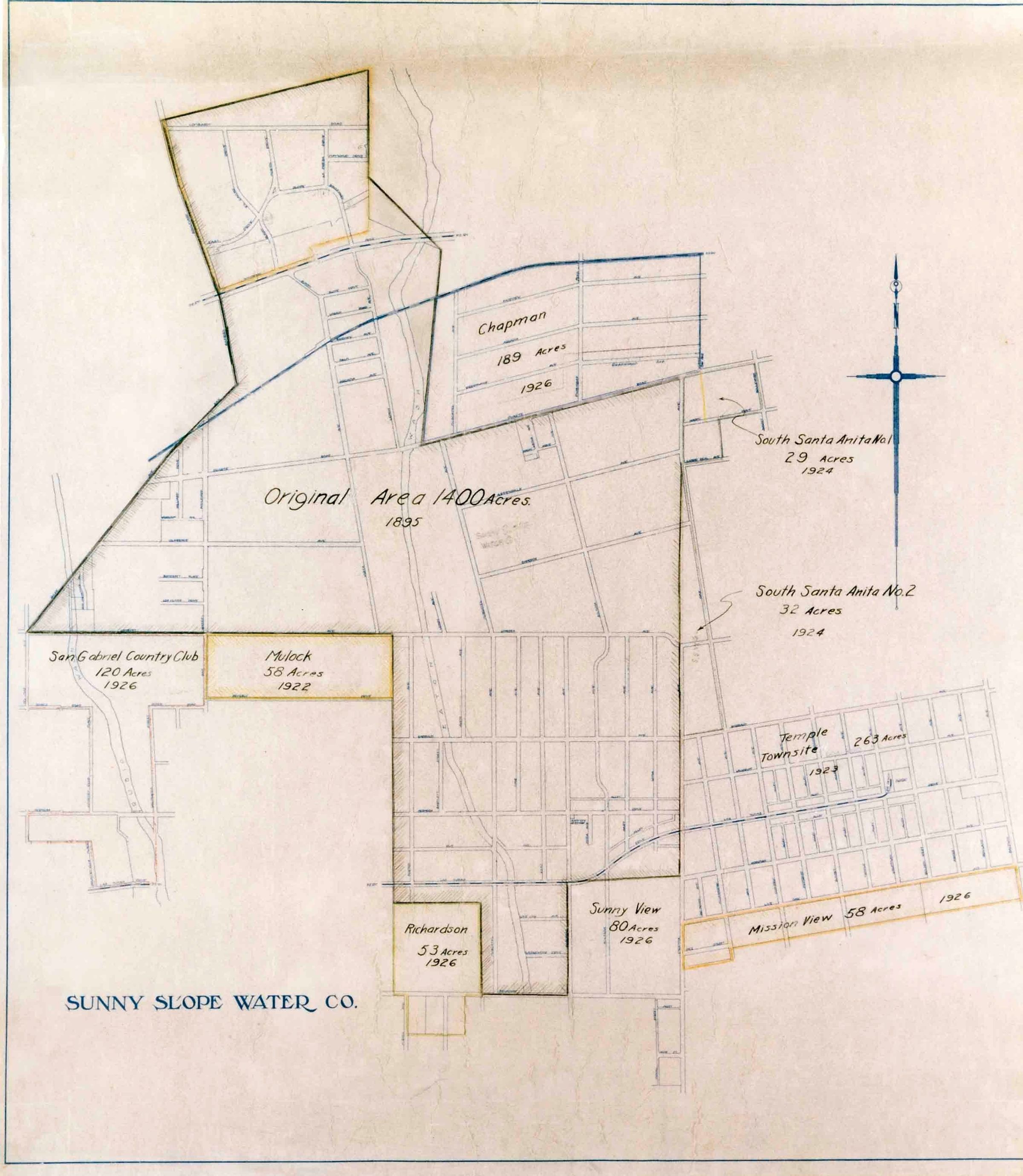
SUNNY SLOPE WATER COMPANY SERVICE AREA MAP, CA. 1931
Entry/Object ID
95.2.1.1
Description
SUNNY SLOPE WATER COMPANY SERVICE AREA MAP, CA. 1931
A color reproduction photograph of the service area of the Sunny Slope Water Company of Pasadena, including Temple City, ca. 1931. The map shows the original service area from 1895 and the number of acres involved. Listed also are subsequent additional areas serviced by the company, including the Temple Townsite of 263 acres, added in 1923. Street layouts and the route of the Pacific Electric Railway line are included. Borders are indicated with yellow, black, and blue lines. There is a directional compass at upper right and the company name at lower left. Photo 95.2.2. is a related image. From a map provided by Michael Hart, president of the Sunny Slope Water Company. In mint condition. None
Number-Units: 1
Lexicon
Search Terms
Documentary Artifact, Photographs, Sunny Slope Water Company, Water-supply--Temple City (Calif.), Water use--Temple City (Calif.)