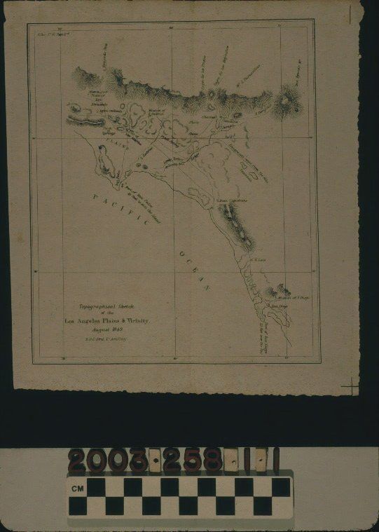
"TOPOGRAPHICAL SKETCH OF THE LOS ANGELES PLAINS AND VICINITY, AUGUST 1849"
Entry/Object ID
2003.258.1.1
Description
"TOPOGRAPHICAL SKETCH OF THE LOS ANGELES PLAINS AND VICINITY, AUGUST 1849"
Color: Black; White
A lithographed map titled "Topographical Sketch of the Los Angeles Plains & Vicinity," by Lieutenant Edward O. C. Ord of the United States Army, August 1849. The item, disbound from a senate publication, which is identified in the upper left corner has the title at the lower left, indications of degrees latitude and longitude on the borders, and provides many features of the region from Mission San Fernando on the north to San Diego on the south and the Pacific Ocean on the west to San Gorgonio Pass and Temecula on the east. Place names, such as Los Angeles and San Diego; rivers; lakes; hills and mountains; canyons and passes; roads; two "pitch springs," these being Brea in modern Orange County and the La Brea area of west Los Angeles; missions; and the ports of San Pedro and San Diego are of interest. With creased corners; some soiling; browning; a center vertical fold; foxing; small stains; and a few small edge tears, probably from disbinding, the overall condition is good.
Lexicon
Search Terms
Two-dimensional, Maps, United States. Army, California, Southern--Surveys, Military topography, Military field engineering, Surveying--California, Southern