Name/Title
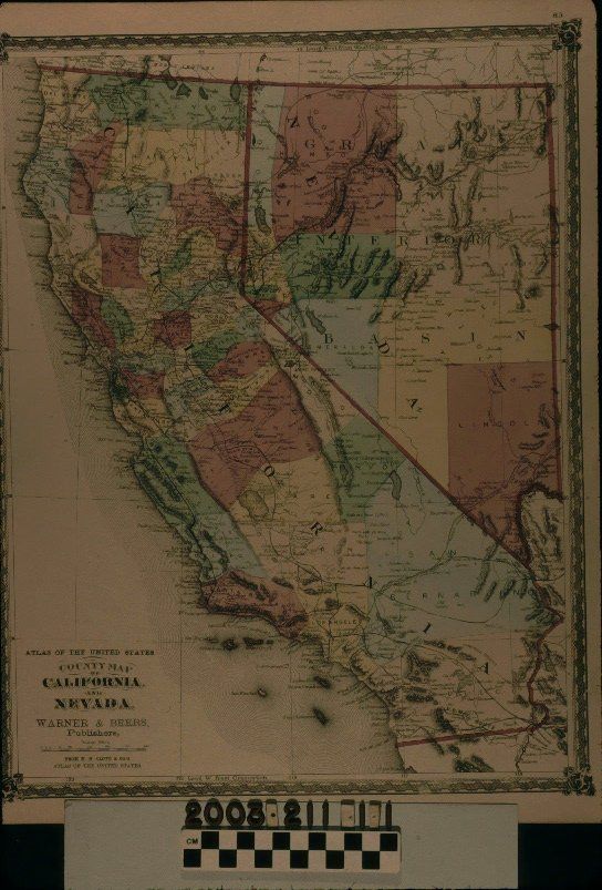
WARNER AND BEERS COUNTY MAP OF CALIFORNIA AND NEVADA, 1874Entry/Object ID
2003.211.1.1Description
WARNER AND BEERS COUNTY MAP OF CALIFORNIA AND NEVADA, 1874
Color: Black; Blue; Brown; Green; Red; Yellow; White
A county map of California and Nevada, published by Warner & Beers and from H. H. Lloyd & Co.'s "Atlas of the United States," 1874. The map has heavy red lines to denote the borders of the two states, although there are small portions of Oregon, Arizona, and Mexico at the edges. On the borders are latitude and longitude markings and an ornate decorative outer border. Counties in the two states are in colors of light brown, blue, green, red, and yellow. Typical features such as cities and towns, bodies of water, mountains and hills, roads and rail lines; islands; and others are indicated. Near each California county name is the date of establishment. At the lower left is the title, the publisher's names, the work from which the map came, and a scale of statute miles. At the top right is the number "83." Of note for Los Angeles County is that the only railroad line is the 1869 Los Angeles and San Pedro line, while roads leading east through Rancho La Puente toward Yuma and north toward Lake Elizabeth and Tehachapi, as well as through the Grapevine, are of note. With light creases; some soiling and browning; small and light stains; and two small edge tears, the overall condition is good.Lexicon
Search Terms
Two-dimensional, Maps, Beers & Warner, H. H. Lloyd and Co., California, Counties--California, Nevada, Counties--Nevada