Name/Title
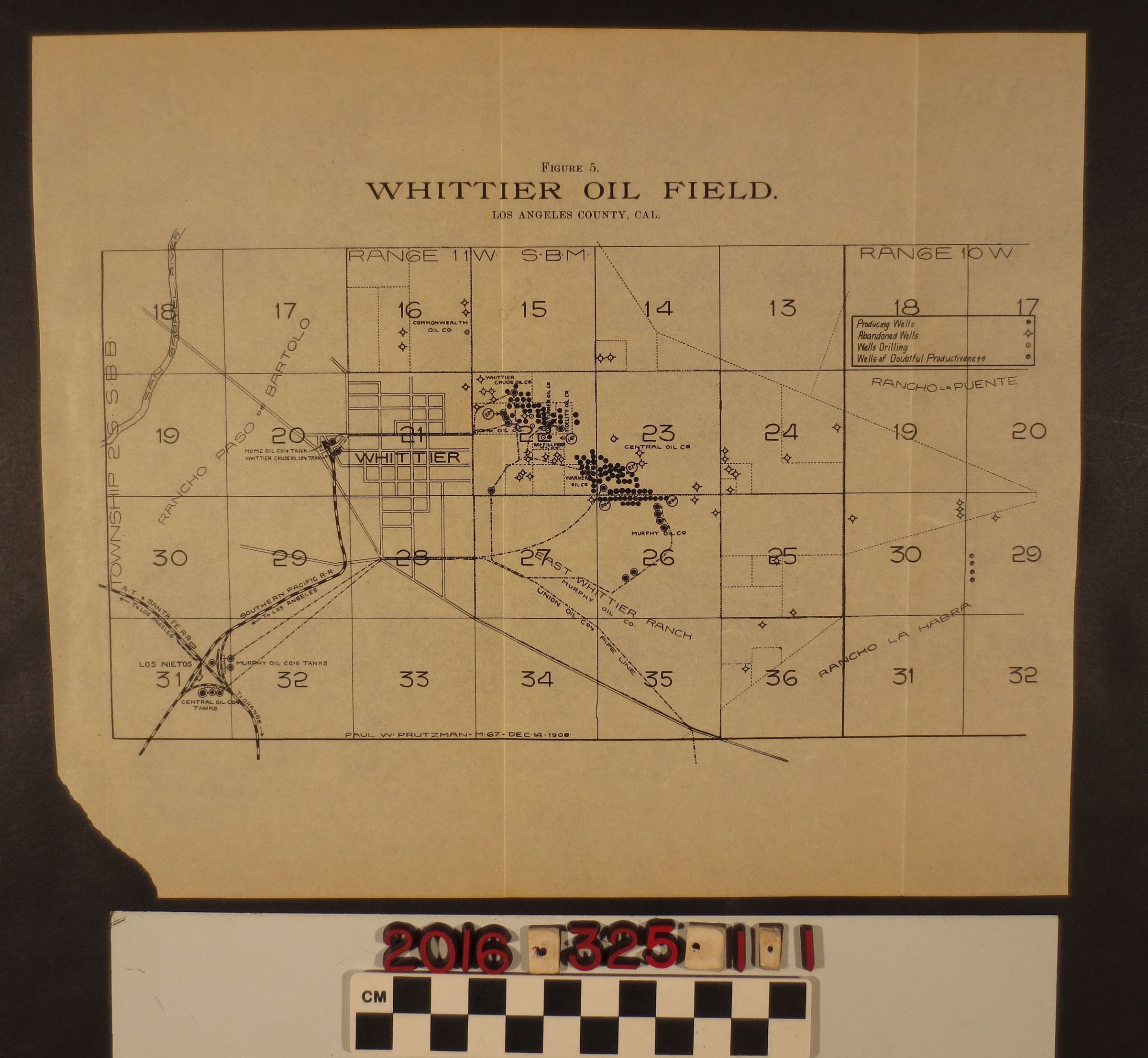
"Whittier Oil Field, Los Angeles County, Cal."Entry/Object ID
2016.325.1.1Description
A map, "Whittier Oil Field, Los Angeles County, Cal." 1906. A fold out map removed from a bound book, this map is figure five. It is gridded and includes sections surrounding the center of Whittier. Included are the Santa Fe and Southern Pacific railroad tracks, Rancho Paso de Bartolo, East Whittier Ranch, Rancho La Habra, Rancho La Puente, San Gabriel River. At the center are indications of locations oil fields for companies: Commonwealth Oil, Whittier Crude Oil, Home Oil, WH Fillmore, Warner Oil, Central Oil, Murphy Oil, Fidelity and Turner. Map drawn by Paul W. Prutzman, 14 December 1906. The map is in good condition overall with minor loss to bottom left corner.