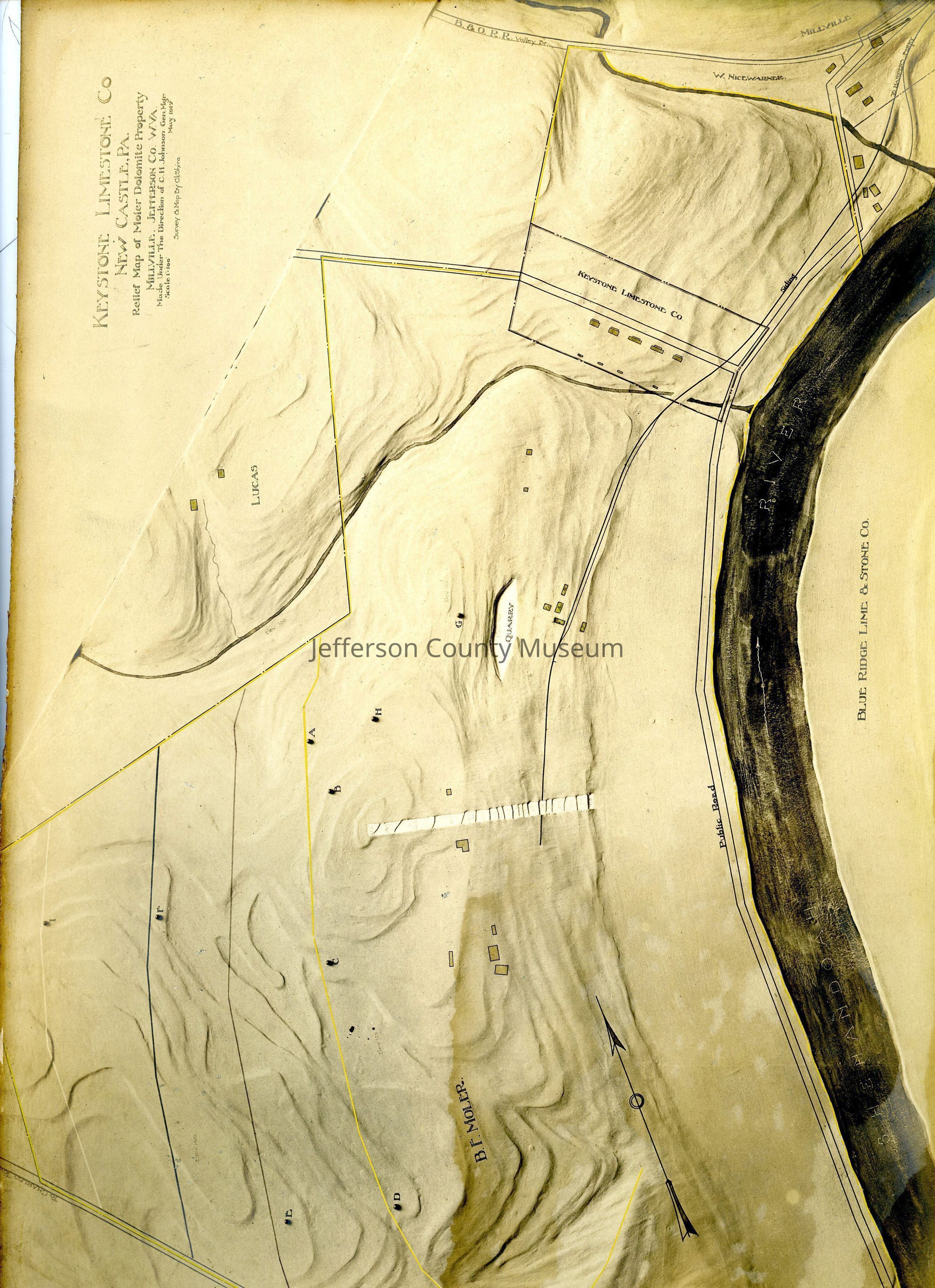
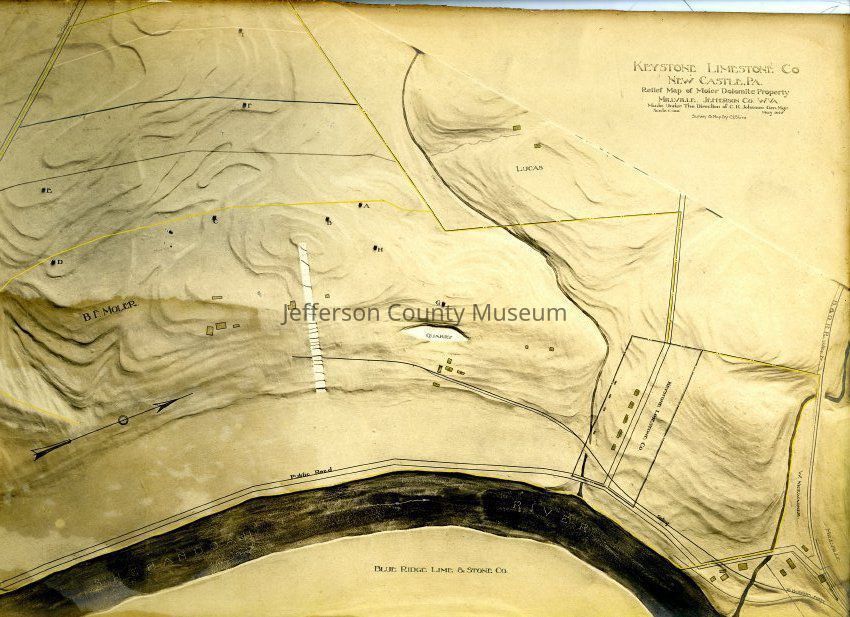
Name/Title
Relief Map of Moler Dolomite Property, Millville, Jefferson County, West VirginiaEntry/Object ID
ARC544Scope and Content
Relief map of Moler Dolomite Property, Millville, Jefferson County, West Virginia, parent company: Keystone Limestone Company, New Castle, PA
Made under the direction of C. H. Johnson, General Manager, 1917
Scale 1:100
Survey & Map by C. L. Shira
Multiple spots indicated by identifying letters but no legend.
Map reads Blue Ridge Lime & Stone Co at the bottom of map, showing property on opposite side of the river.
B&O Railroad line at far right margin, railroad siding into Moler Dolomite Property shown, Shenandoah River in foreground
Also shows property lines for land owned by Wetzel, Tyler, Lucas, W, Nicewarner, B.F. Moler and quarry site.Acquisition
Accession
567Source or Donor
Lanning, Bruce and NancyAcquisition Method
GiftArchive Details
Creator
C. L. ShiraDate(s) of Creation
1917Archive Notes
Date(s): 1917 May