Name/Title
Interpretive map of John Brown's Raid at Harpers Ferry National Monument in 1955Entry/Object ID
IMG1011Description
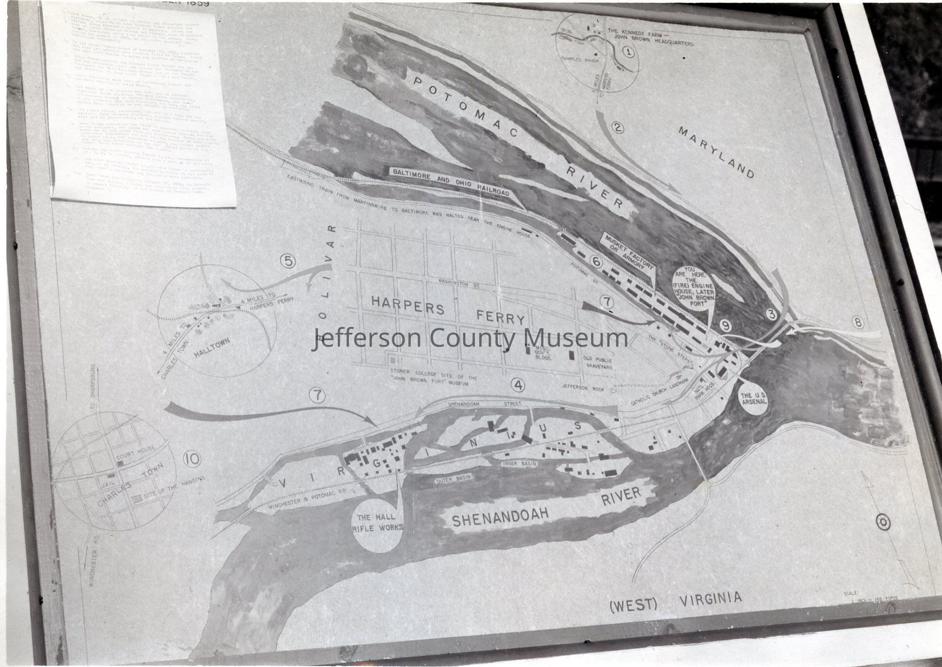
Interpretive map of John Brown's Raid at Harpers Ferry National Monument in 1955. In 1955 the state of West Virginia was beginning to acquire properties to donate to the NPS. This map was located on the original site of the armory fire engine-guard house which became known as John Brown's Fort. The location is marked today by a granite monument labeled simply "John Brown's Fort." This interpretive wayside map identified 10 locations pertinent to the raid starting with #1 the Kennedy Fair and ending with #10 the Jefferson County court house and Jail in nearby Charlestown. A type-written numbered legend to the map is visible in the upper left hand corner.Acquisition
Accession
48Source or Donor
Jefferson County Historical SocietyAcquisition Method
GiftMade/Created
Place
* Untyped Place
Harpers Ferry, West VirginiaNotes
Date: 1955 circa
Medium: Photographic Paper