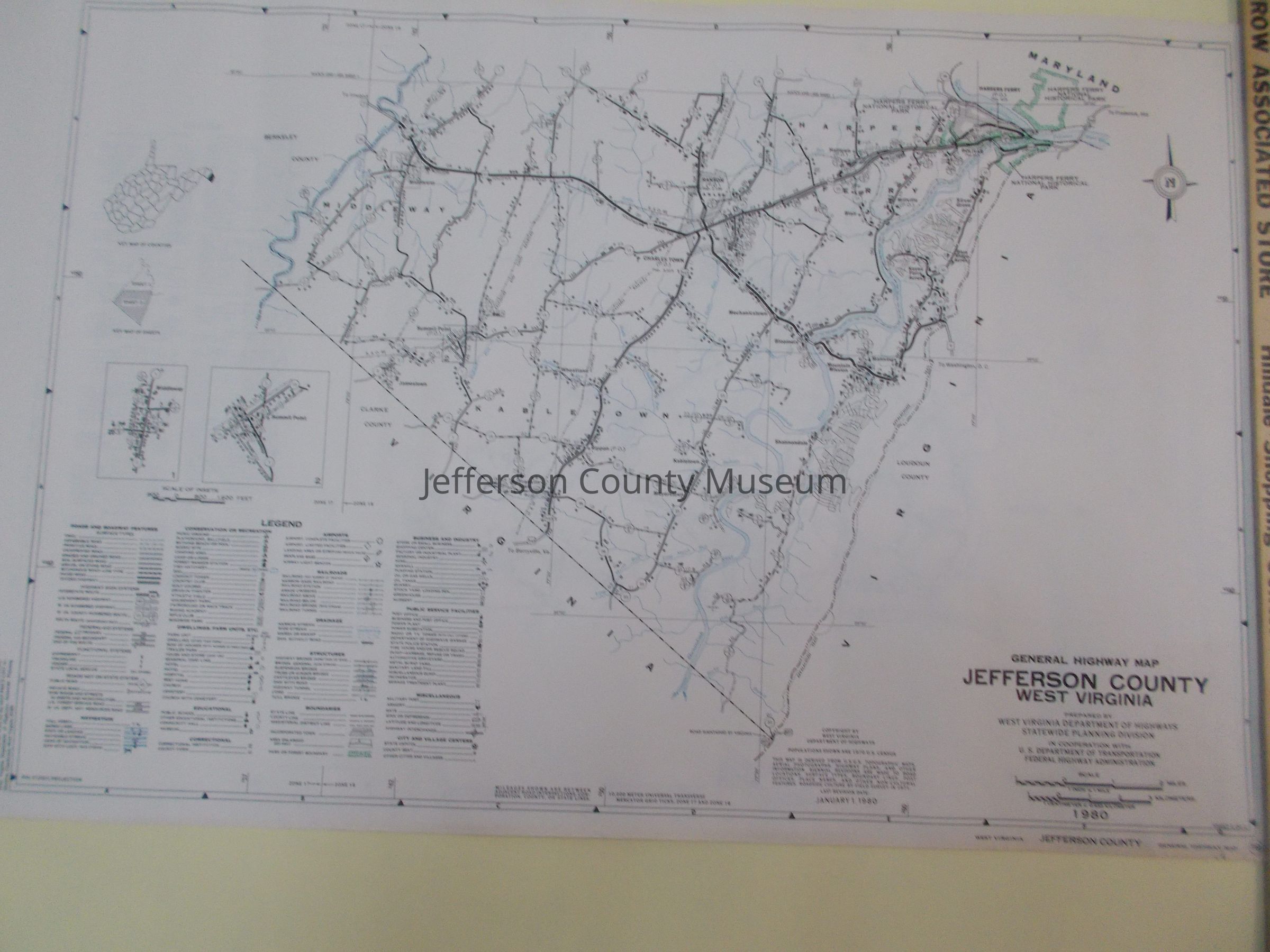
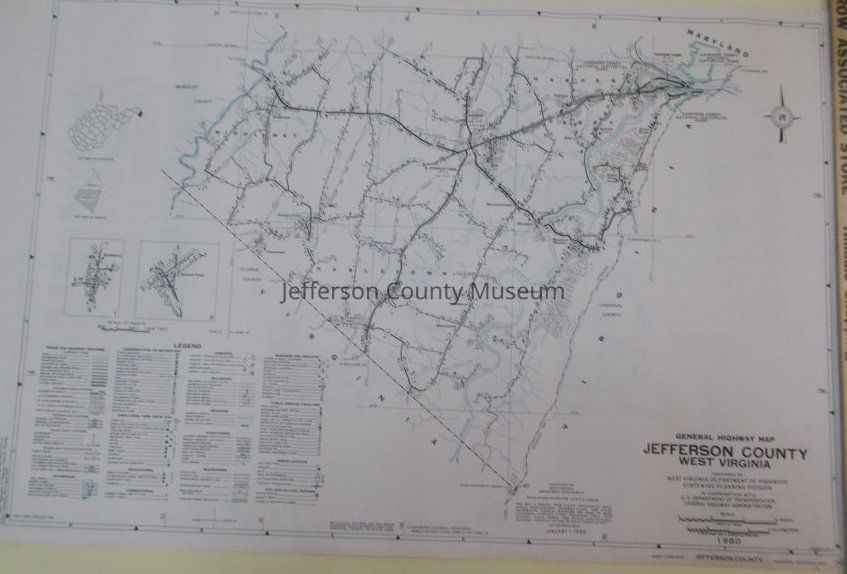
Name/Title
Highway Map of Jefferson County, West VirginiaEntry/Object ID
ARC162Description
Highway map of Jefferson County showing southern portion of Jefferson County (it should be accompanied by Sheet 1 [ARC163] which shows the northern portion of Jefferson County). Towns and communities reflect populations from 1970 census; highways and roads are in black with route numbers; railroads are in black; rivers and streams are in blue; Harpers Ferry National Historical Park is outlined in green.
Insets: Middleway, Summit Point, and legendAcquisition
Accession
00Source or Donor
Found in collectionAcquisition Method
GiftMap Details
Scale
1" = 1 mileArea or Region
* Untyped Area or Region
Southern portion of Jefferson County, West VirginiaProjection
Polyconic ProjectionPublisher
West Virginia Department of HighwaysPlace Published
* Untyped Place Published
Charleston, West VirginiaDate Published
1980Medium
PaperPublication Language
English