Name/Title
Sanborn Map of Charles Town, Jefferson County, West Virginia.Entry/Object ID
ARC241Description
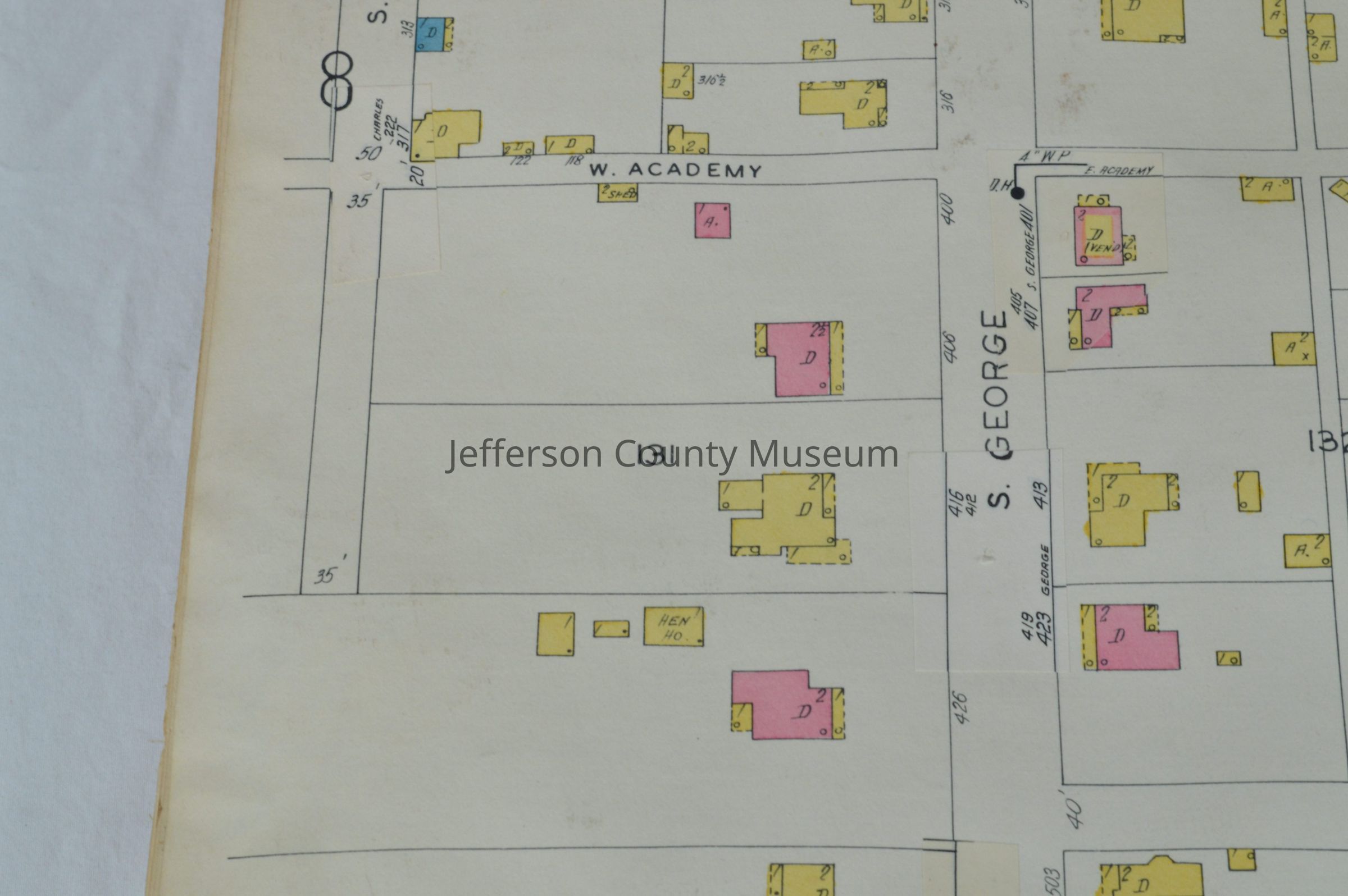
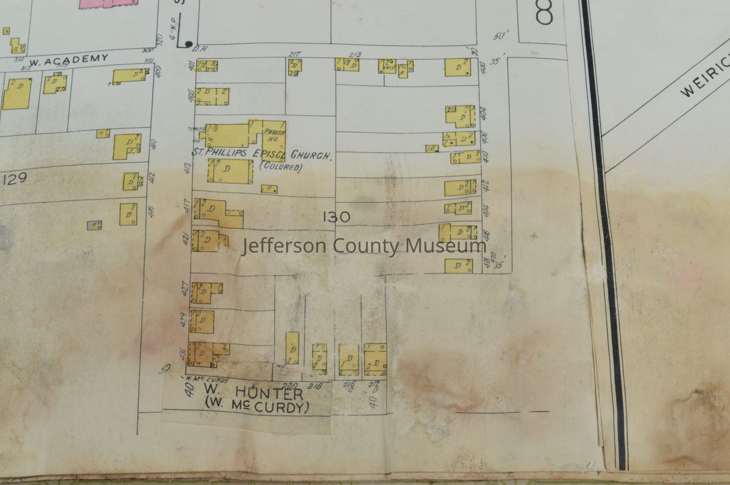
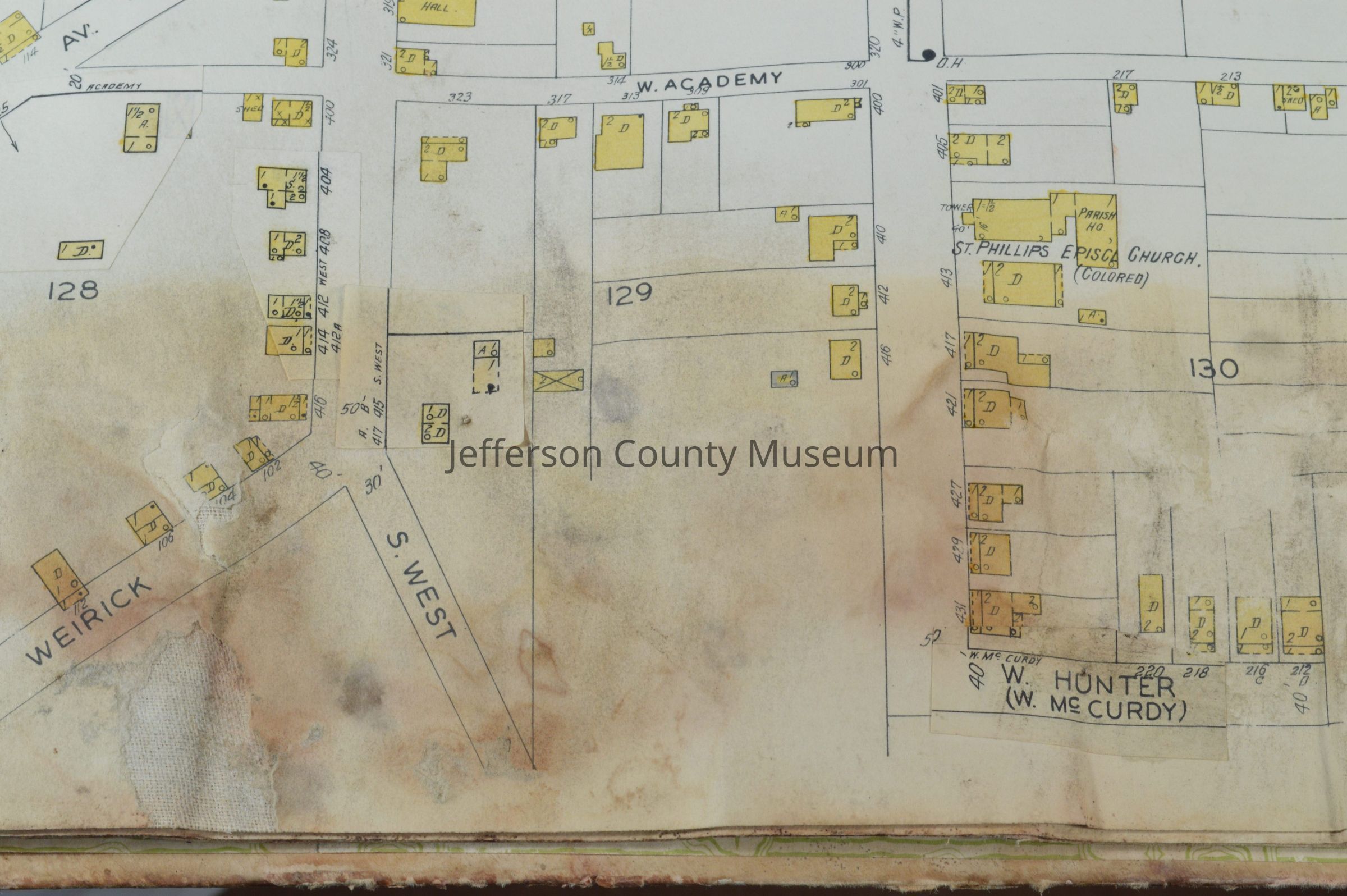
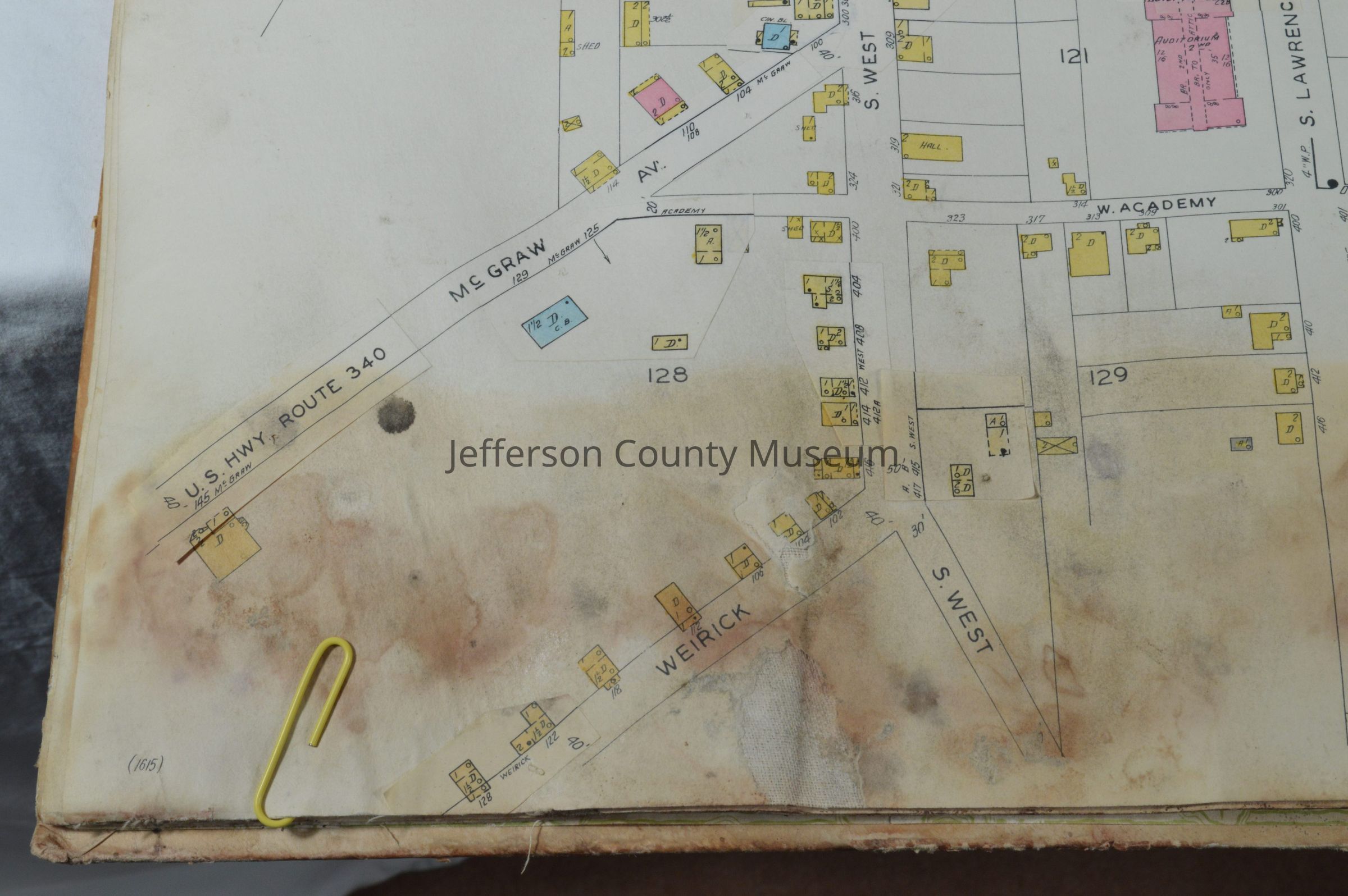
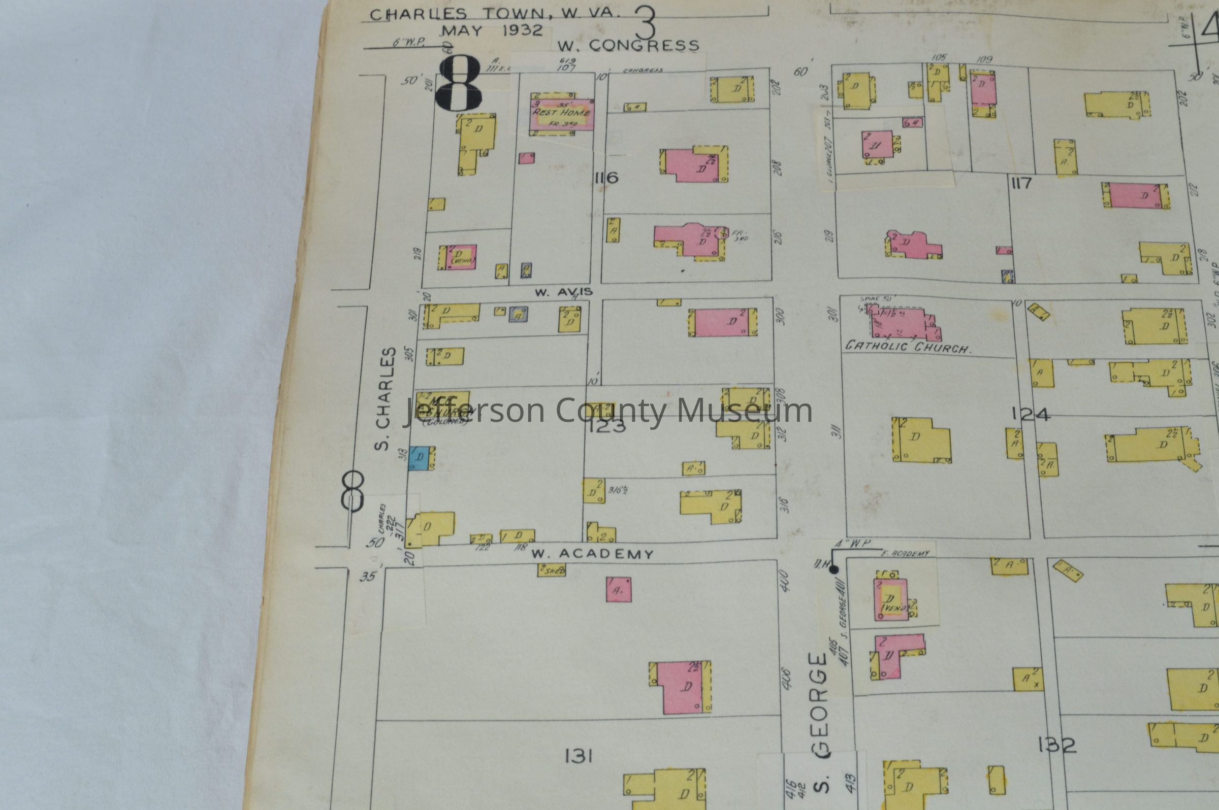
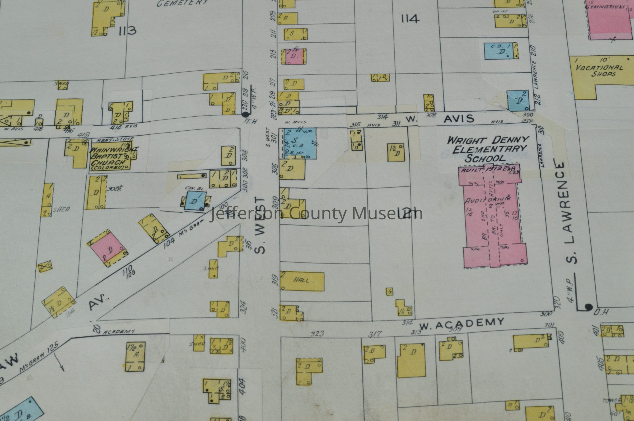
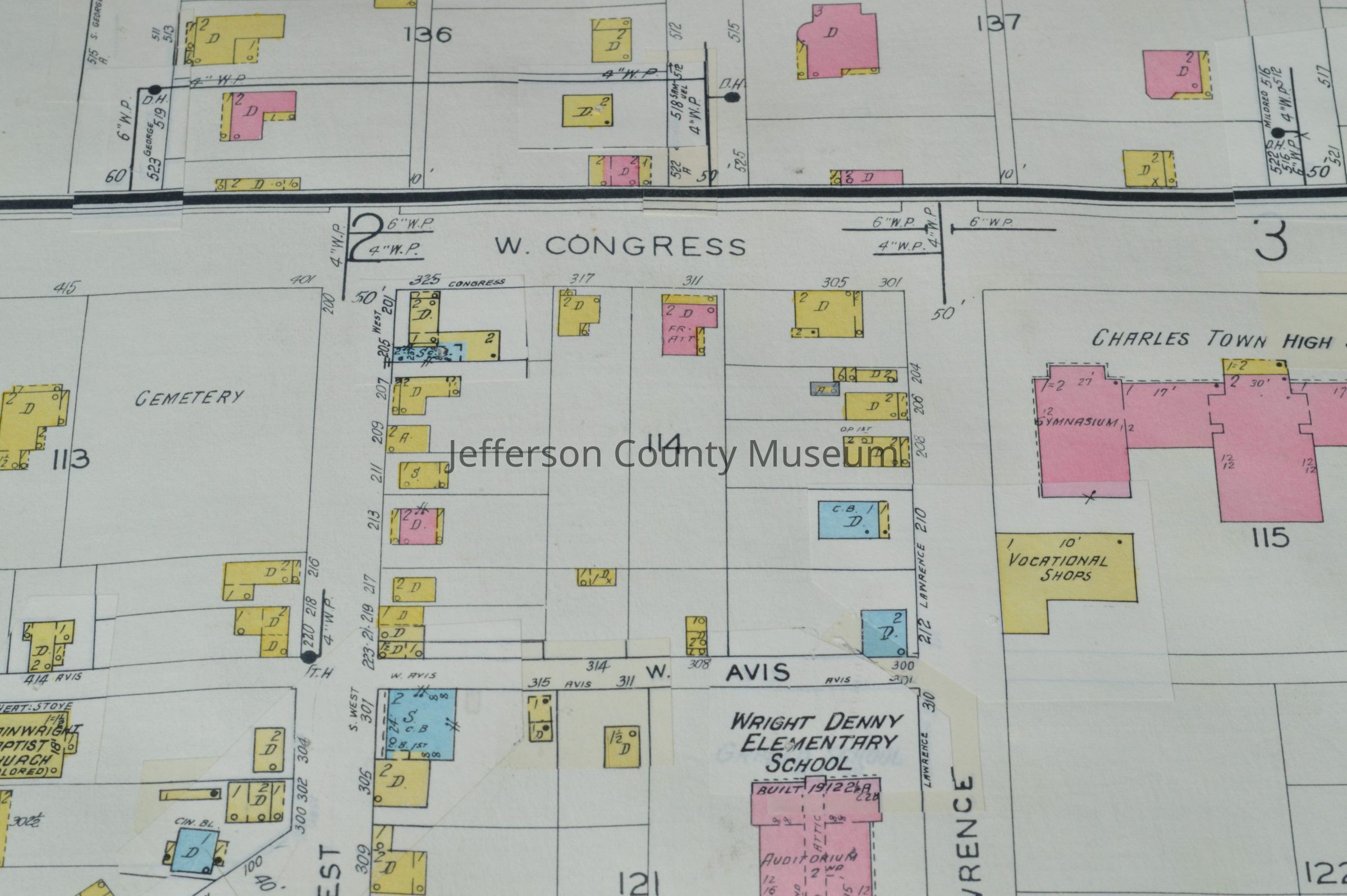
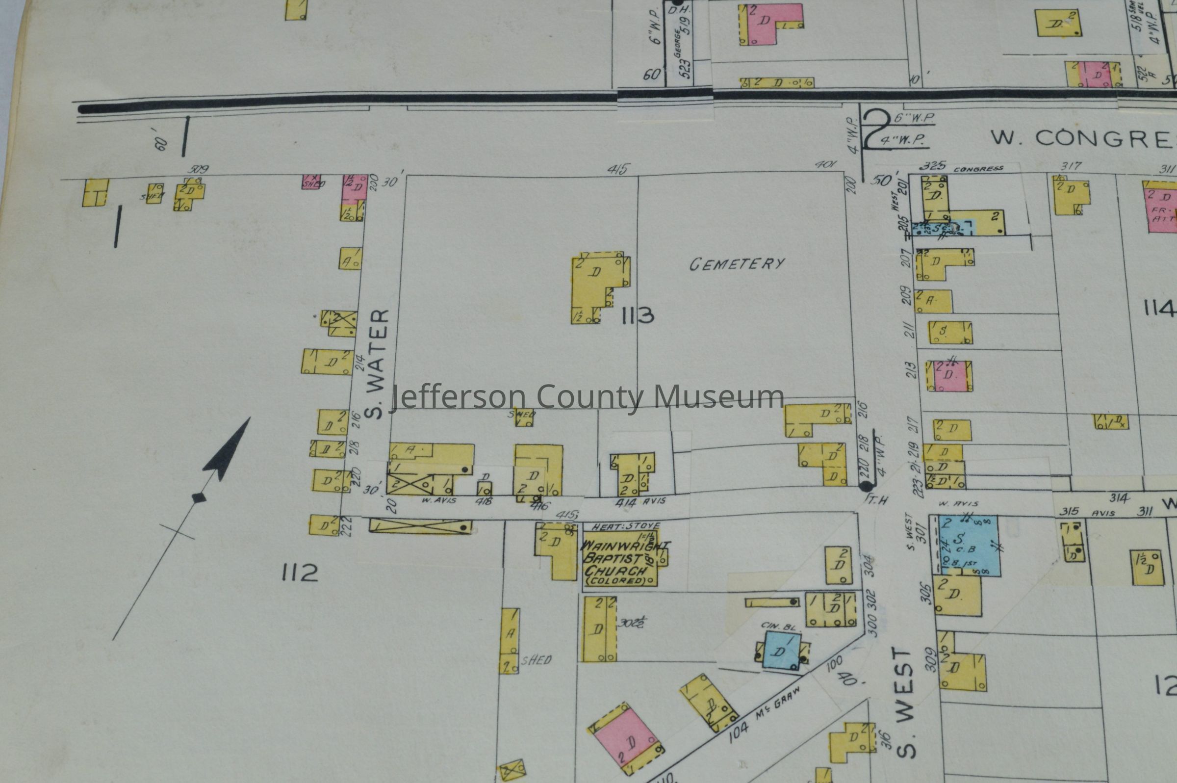
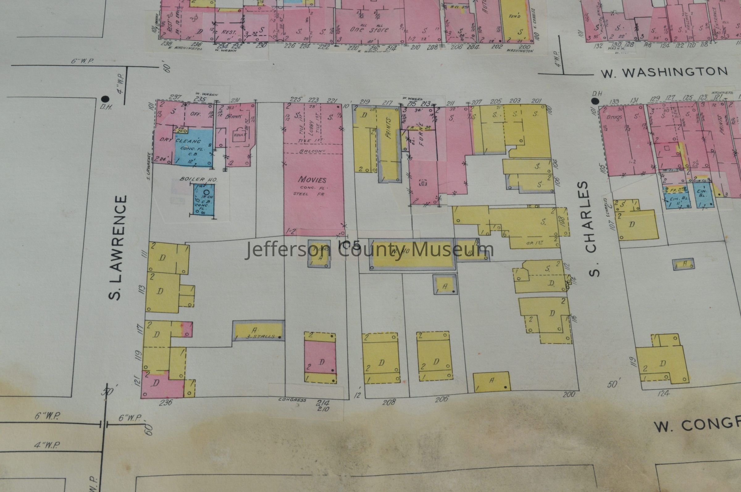
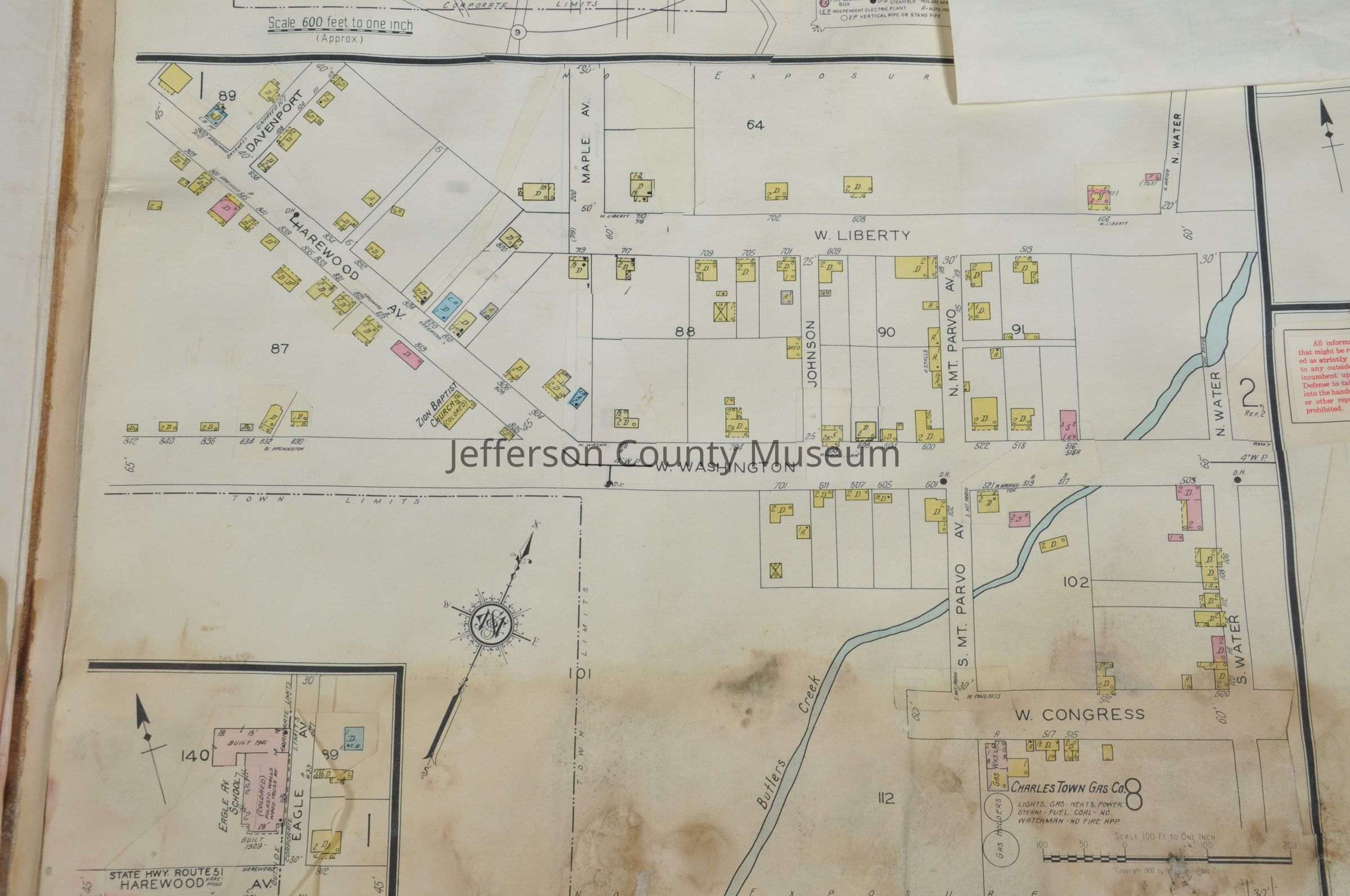
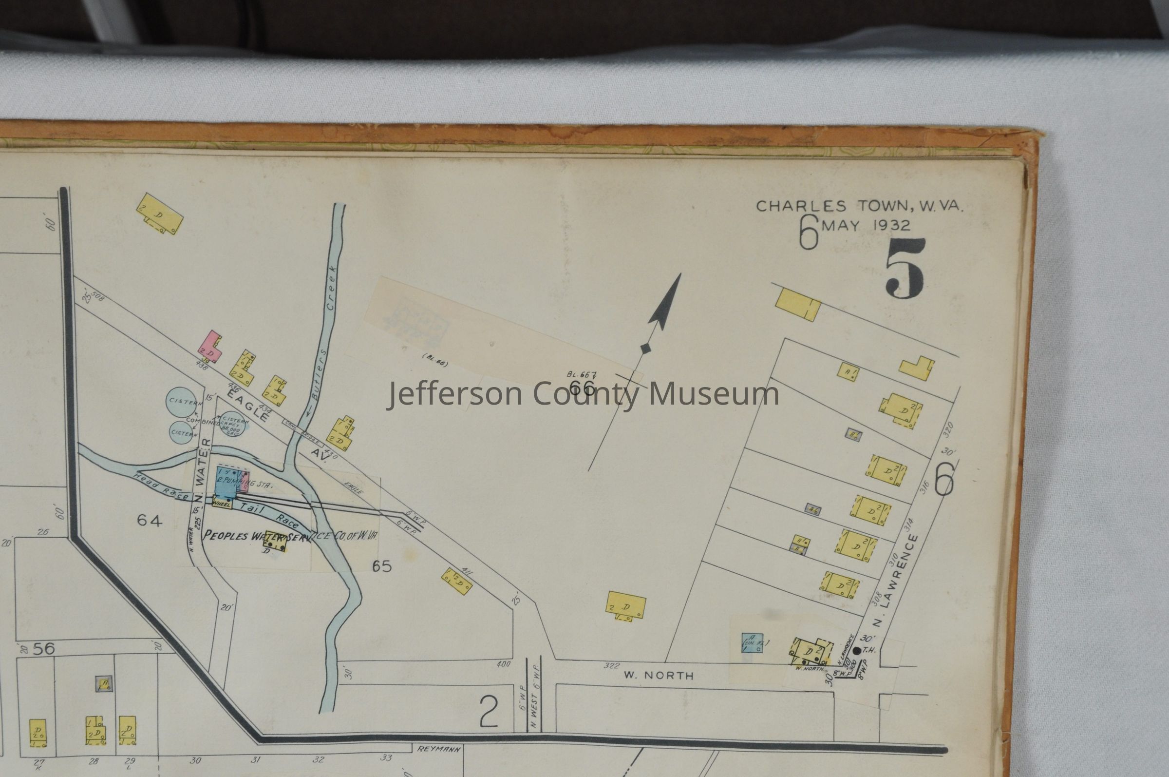
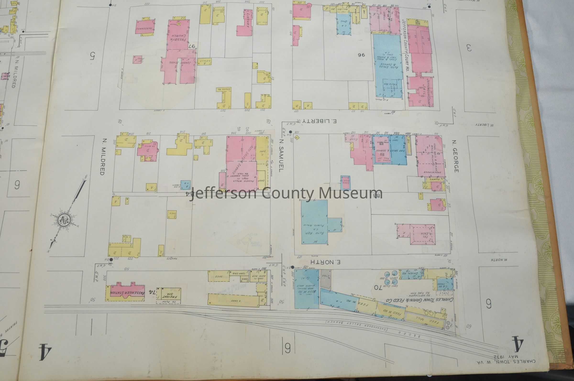
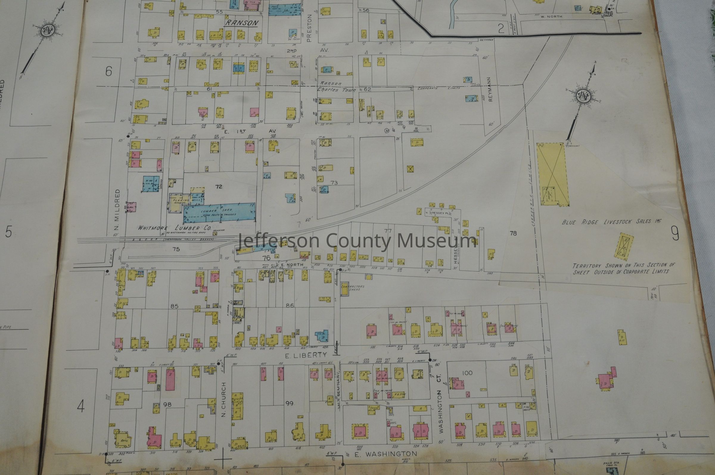
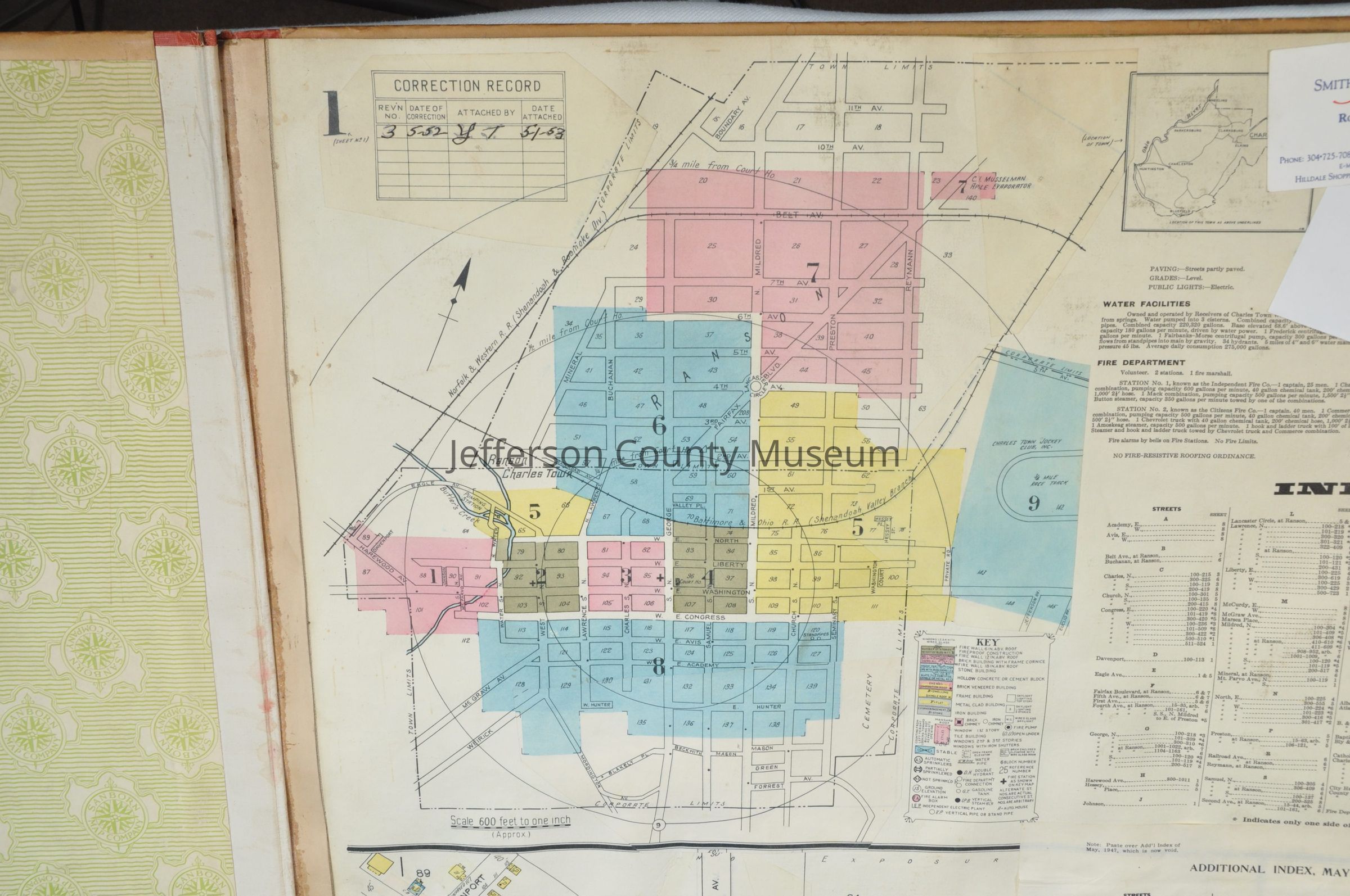
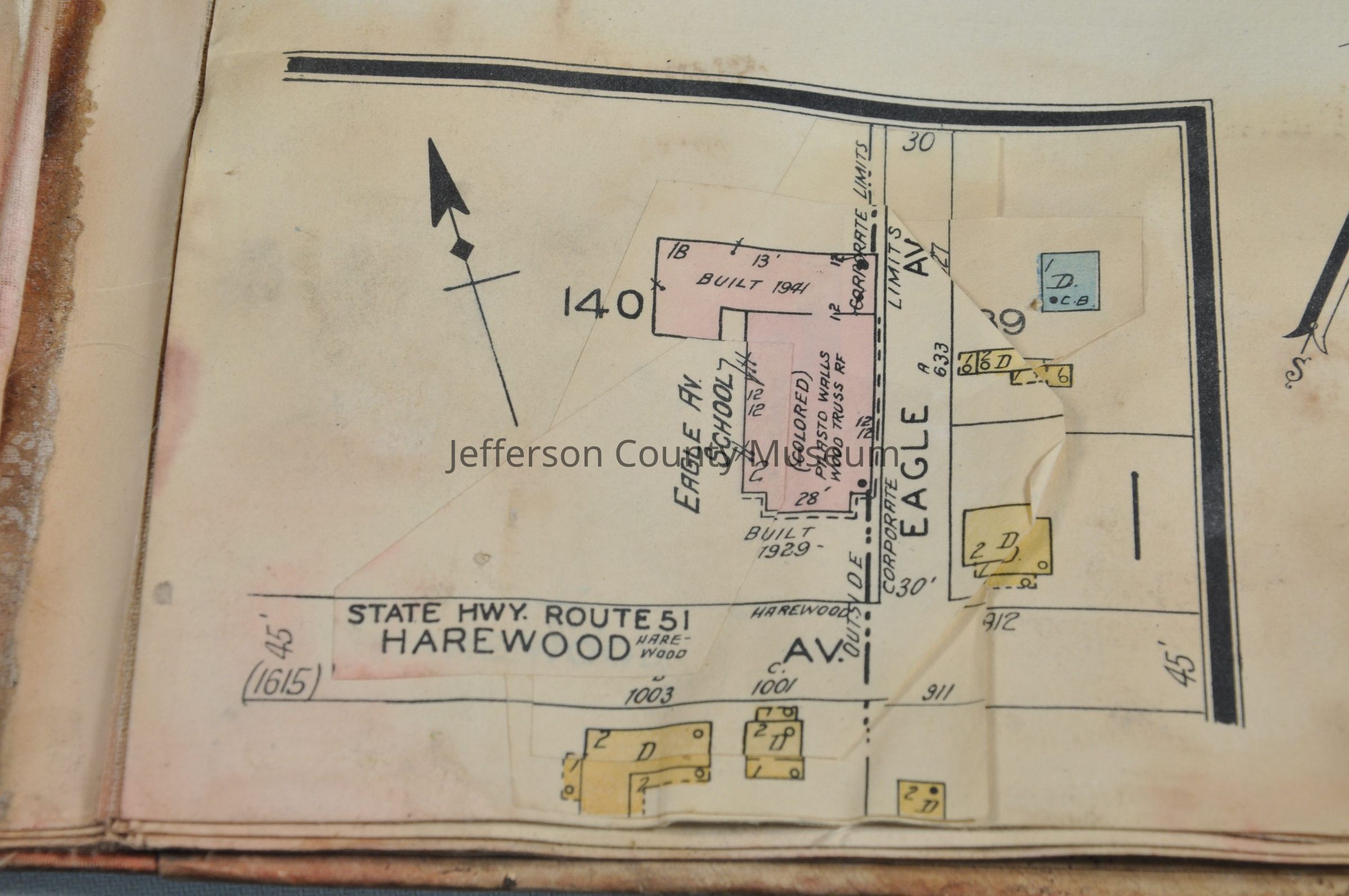
Hardbound book of color-coded maps of Charles Town and Ranson in 1932, with corrections in the 1950s. 9 pages of maps showing locations and types of buildings, water facilities, fire departments, schools, etc.; includes, among many others, , Blue Ridge Livestock Sales, Inc., Charles Town Jockey Club, Inc., Eagle Avenue School, Halltown Paper Board Co., Ranson Fruit Co., Zion Baptist Church. Correction Record pasted in upper right corner on page 1: Rev'n No. 3, Date of Correction 5-52. Red cloth tape binding. Stenciled in black on front cover: "Charles Town, W. VA.".
(Also photocopies of info on Sanborn maps of Charles Town, Harpers Ferry, Shepherdstown in Library of Congress and on keys to symbols on maps)
Photos of 16 pages of the maps may be found in Media.
Insets: Index (original) and Additional Index, May, 1952 on page 1. Inset of Halltown, WV on page 8.Acquisition
Accession
536Source or Donor
Smith Nadenbousch Insurance, Inc.Acquisition Method
GiftMap Details
Area or Region
* Untyped Area or Region
Charles Town, Ranson, and Halltown, West Virginia.Publisher
Sanborn Map CompanyPlace Published
* Untyped Place Published
New York, New YorkDate Published
1932Medium
Paper and boardPublication Language
English