Name/Title
Electric Light & Power Line for ClaymontEntry/Object ID
ARC247Description
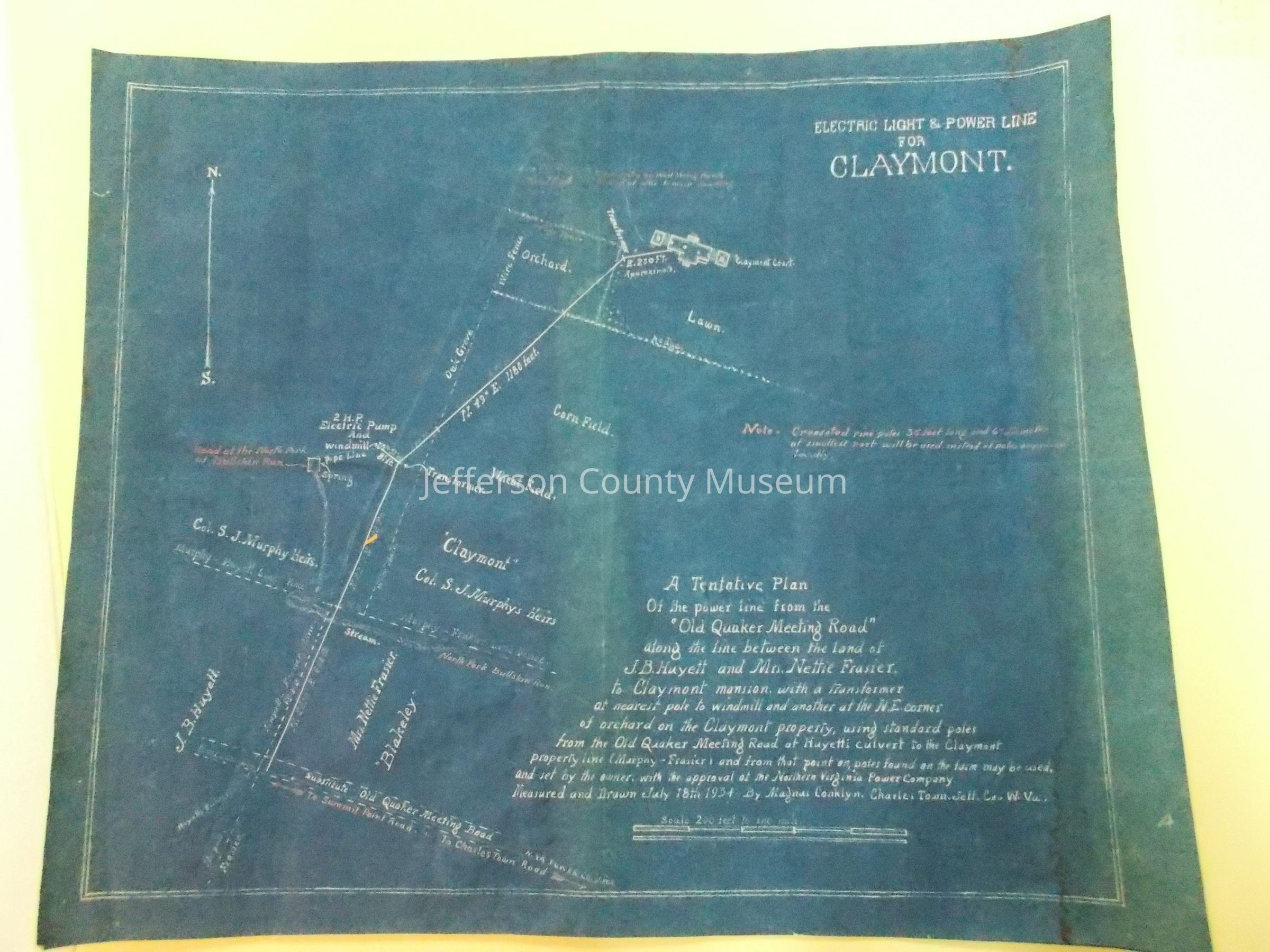
Blueprint map for the Northern Virginia Power Company power line from the "Old Quaker Meeting Road" to Claymont Farm, also showing abutting property belonging to J.B. Huyett and to Mrs. Nettie Frasier. Also shows the head of the North Fork of the Bullskin Run.Acquisition
Accession
42Source or Donor
Hankey, RosaAcquisition Method
GiftCredit Line
NB: No Deed of Gift on record for this donor as of 2/6/14Map Details
Scale
200' = 1"Area or Region
* Untyped Area or Region
Claymont, southwest of Charles Town, WVPublisher
Magnus ConklynPlace Published
* Untyped Place Published
Charles Town, WVDate Published
Jul 18, 1934Medium
Paper & Prussian BluePublication Language
EnglishMap Notes
Date(s): 1934