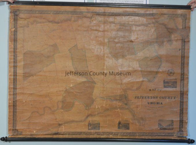
Name/Title
1852 map of Jefferson County, Virginia, by S. Howell BrownEntry/Object ID
ARC635Description
1852 map of Jefferson County, Virginia by S. Howell Brown showing farms and the owners' names. Includes population table and table of the fall in the Shenandoah River. Insets include views of Charles Town, Shepherdstown, Harpers Ferry, and Shannondale Springs. Wooden roller along one end, wooden stretcher along opposite end. Size does not include roller or stretcher.Acquisition
Accession
405Source or Donor
Ijams, Sarah Howell BlatchfordAcquisition Method
GiftMap Details
Area or Region
* Untyped Area or Region
Jefferson County, WV (then Virginia)Date Published
1852Medium
Paper on fabric backing