Name/Title
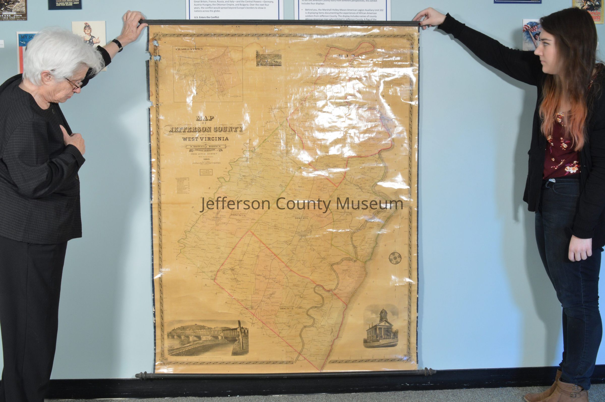
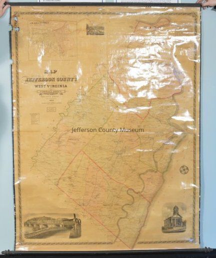
1883 map of Jefferson County, West Virginia. by S. Howell Brown.Entry/Object ID
ARC636Description
Map of Jefferson County West Virginia by S. Howell Brown County Surveyor from Actual Survey with Farm Limits. 1883. Shows farm boundaries and names of the farm owners. Also has view of Harpers Ferry from the Maryland shore and picture of Court House. Includes map of Charles Town with designation of the wards. Table of the fall of the Shenandoah River. Wooden roller along one end, wooden stretcher along opposite end. Size does not include roller or stretcher.
Insets: Map of Charles Town, showing the Wards.Acquisition
Accession
00Source or Donor
Found in collectionAcquisition Method
GiftMap Details
Area or Region
* Untyped Area or Region
Jefferson County, West VirginiaPublisher
J. L. Smith, Map Publisher and ManufacturerPlace Published
* Untyped Place Published
Philadelphia, PADate Published
1883Medium
Paper on fabric backingPublication Language
English