Name/Title
Kahoolawe Training AreaEntry/Object ID
2009.002.1Description
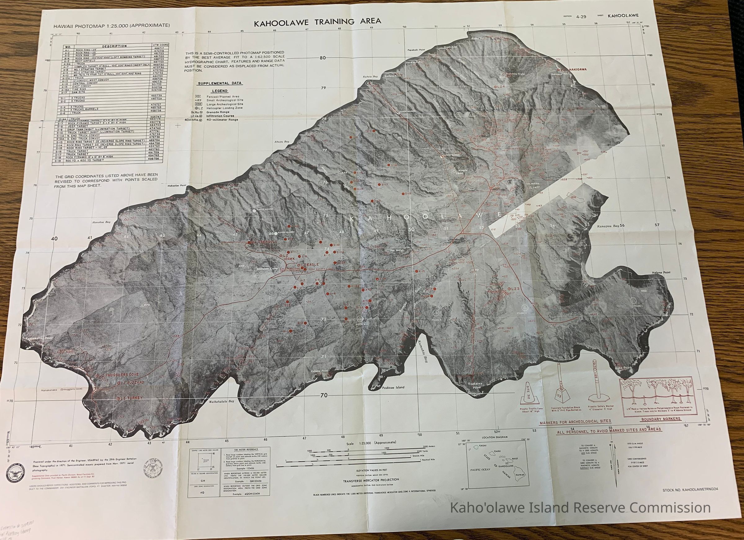
Hawaii Photomap of Kahoolawe Training Area. The map has archaeological site numbers superimposed on it. Also lists helicopter landing zones, grenade ranges, infiltration courses and 40-millimeter range.
It is a semicontrolled mosaic prepared from Nov. 1971 aerial photography.
Insets: In LR quadrant of the map an inset shows all 8 main Hawaiian Islands. In the LL quadrant of the map an inset has legend regarding meter reference and examples of how to report.
East Longitude: 156 31'
North Latitude: 20 36'40
South Latitude: 20 30'12
West Longitude: 156 42'1Collection
KIRC AdministrationCataloged By
Gavagan,TerriLexicon
Nomenclature 4.0
Nomenclature Secondary Object Term
MapNomenclature Primary Object Term
CartographNomenclature Sub-Class
Graphic DocumentsNomenclature Class
Documentary ObjectsNomenclature Category
Category 08: Communication ObjectsLOC Thesaurus for Graphic Materials
Administrative agencies, Archaeological sites, Military trainingSearch Terms
administrative records, archaeological sites, cultural resources, maps, militaryMap Details
Scale
1:25,000Area or Region
Ahupua'a
Kaho'olaweMoku
Honua'ulaMokupuni
Maui MokupuniState/Province
Hawai'iCountry
United States of AmericaProjection
Transverse MercatorVolume/Number/Issue
Stock No. KAHOOLAWETRN04Publisher
Department of Defense, United States of AmericaDate Published
circa Sep 11, 1980Medium
PaperPublication Language
EnglishCall No.
MAP-71Other Names and Numbers
Other Numbers
Number Type
Other NumberOther Number
MAP-71Relationships
Related Places
Place
Ahupua'a
Kaho'olaweMoku
Honua'ulaMokupuni
Maui MokupuniState/Province
Hawai'iCountry
United States of America