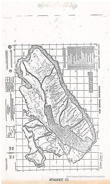
Name/Title
Kahoolawe Training AreaEntry/Object ID
2011.001.280Description
Copy of map of Kahoolawe Training Area labeled as Attachment 3 to draft consent decree (KIRC Object ID #2011.001.274). Notated as Attachment (3) from the Draft Consent Decree (KIRC Object ID #2011.001.274)Collection
Kaho'olawe CollectionCataloged By
Gavagan,TerriLexicon
Nomenclature 4.0
Nomenclature Primary Object Term
Copy, ReprographicNomenclature Sub-Class
Other DocumentsNomenclature Class
Documentary ObjectsNomenclature Category
Category 08: Communication ObjectsLOC Thesaurus for Graphic Materials
Documents, MapsSearch Terms
administrative records, maps, US Navy, militaryMap Details
Scale
1:25,000Area or Region
Ahupua'a
Kaho'olaweMoku
Honua'ulaMokupuni
Maui MokupuniState/Province
Hawai'iCountry
United States of AmericaPublication Language
English/HawaiianRelationships
Related Places
Place
Ahupua'a
Kaho'olaweMoku
Honua'ulaMokupuni
Maui MokupuniState/Province
Hawai'iCountry
United States of AmericaCopyright
Notes
Copies may be obtained from this repository. Search fee and reproduction costs may be assessed.