Name/Title
Kaho'olawe MapEntry/Object ID
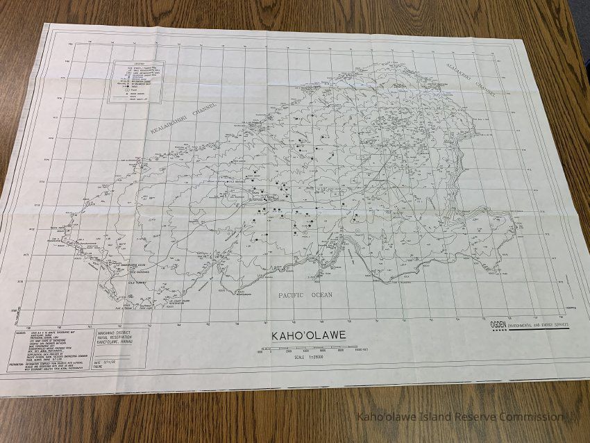
2009.002.4Description
Clean copy of map of Kahoolawe in black & white.
Insets: UL quadrant legend inset; LR quadrant geographic location inset; inset with source and preparation information
East Longitude: 156 31'
North Latitude: 20 36'40
South Latitude: 20 30'12
West Longitude: 156 42'1Collection
KIRC AdministrationCataloged By
Gavagan,TerriLexicon
Nomenclature 4.0
Nomenclature Secondary Object Term
MapNomenclature Primary Object Term
CartographNomenclature Sub-Class
Graphic DocumentsNomenclature Class
Documentary ObjectsNomenclature Category
Category 08: Communication ObjectsLOC Thesaurus for Graphic Materials
Administrative agencies, Archaeological sitesSearch Terms
administrative records, archaeological sites, cultural resources, maps, militaryMap Details
Maker or Creator
Ogden Environmental & Energy ServicesScale
1:25,000Area or Region
Ahupua'a
Kaho'olaweMoku
Honua'ulaMokupuni
Maui MokupuniState/Province
Hawai'iCountry
United States of AmericaDate Published
circa Sep 11, 1980Medium
PaperPublication Language
English/HawaiianCall No.
MAP-92Other Names and Numbers
Other Numbers
Number Type
Other NumberOther Number
MAP-92Dimensions
Dimension Notes
35.5" x 25"Relationships
Related Places
Place
Ahupua'a
Kaho'olaweMoku
Honua'ulaMokupuni
Maui MokupuniState/Province
Hawai'iCountry
United States of America