Name/Title
Location Map KahoolaweEntry/Object ID
2011.019.30Scope and Content
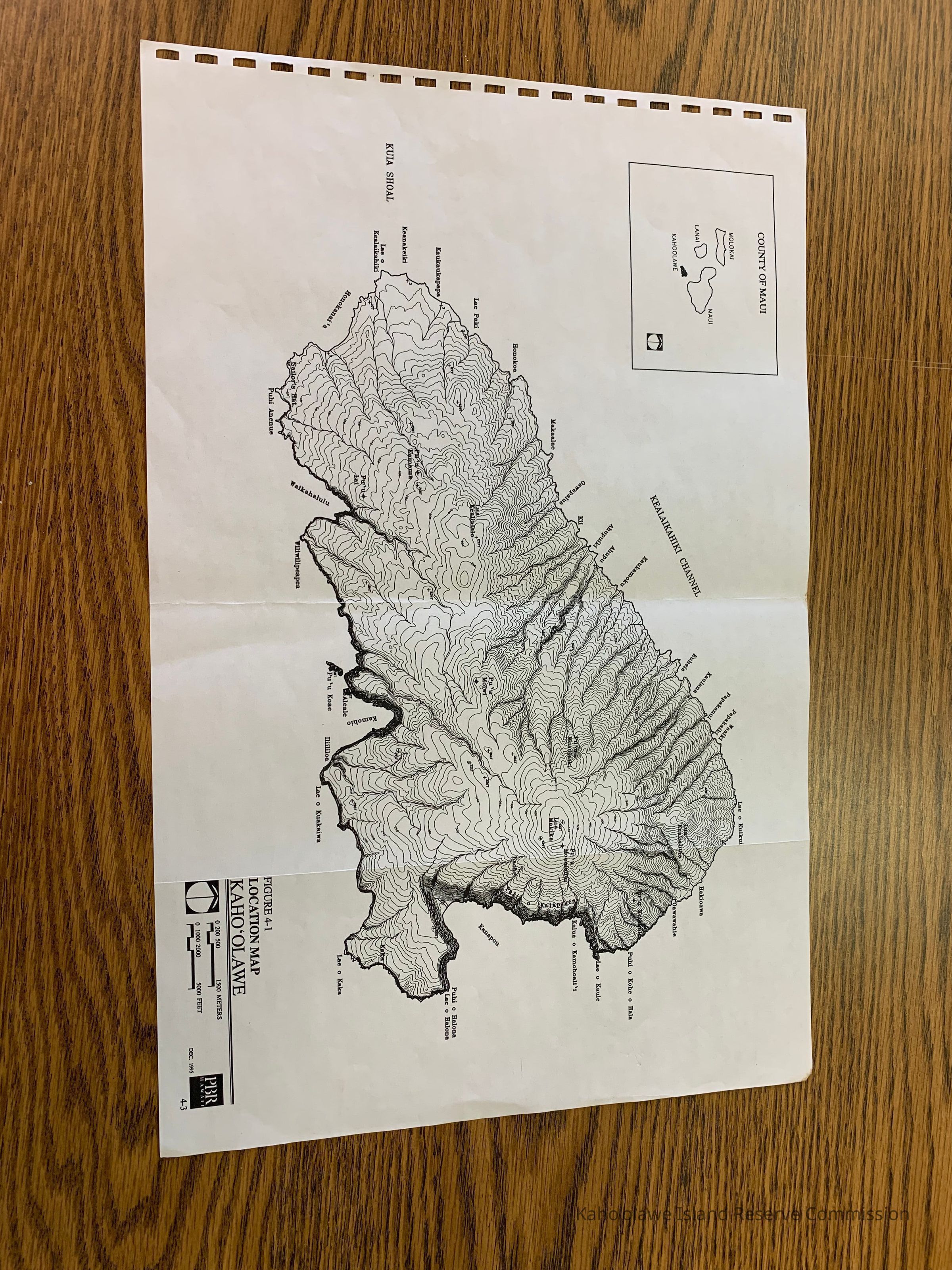
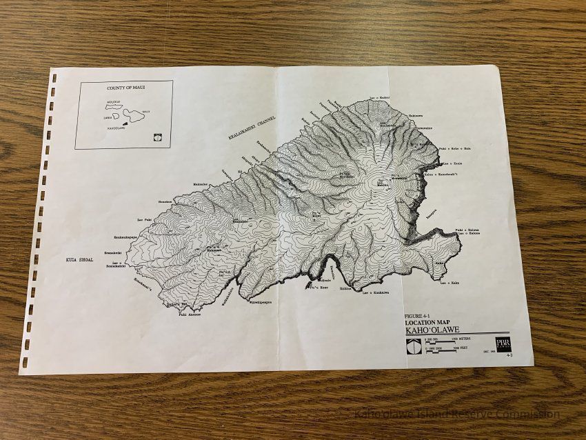
Location Map, Kahoolawe. Labeled Figure 4-1 for unknown publication. Map has inset of County of Maui. It includes some place names. Scale is 0-1500 meters/1-5000 feet.
Insets: County of MauiCollection
KIRC AdministrationCataloged By
Gavagan,TerriLexicon
Nomenclature 4.0
Nomenclature Secondary Object Term
MapNomenclature Primary Object Term
CartographNomenclature Sub-Class
Graphic DocumentsNomenclature Class
Documentary ObjectsNomenclature Category
Category 08: Communication ObjectsLOC Thesaurus for Graphic Materials
MapsSearch Terms
Administrative Records, Maps, administrative records, mapsArchive Items Details
Title
Location Map Kaho'olaweDescription
Location Map, Kahoolawe.Creator
PBR HawaiiDate(s) of Creation
Dec 1995Subjects
MapsNotes
Location: Storeroom
Container: Archive Map Drawer 1Relationships
Related Places
Place
Ahupua'a
Kaho'olaweMoku
Honua'ulaMokupuni
Maui MokupuniState/Province
Hawai'iCountry
United States of AmericaCopyright
Notes
Copies may be obtained from this repository. Search fee and reproduction costs may be assessed.