Name/Title
Vegetation Distribution Kaho'olaweEntry/Object ID
2011.019.32Scope and Content
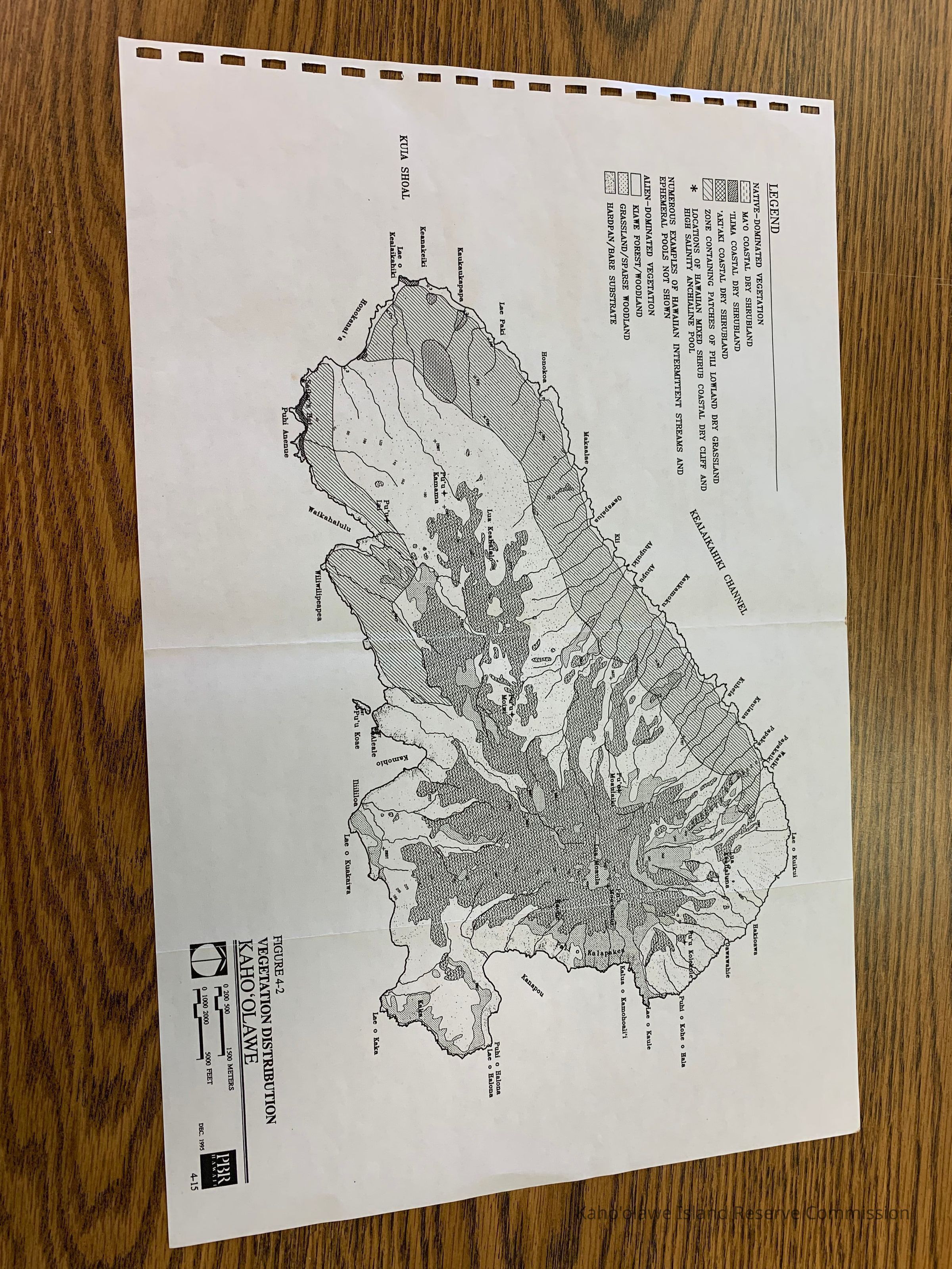
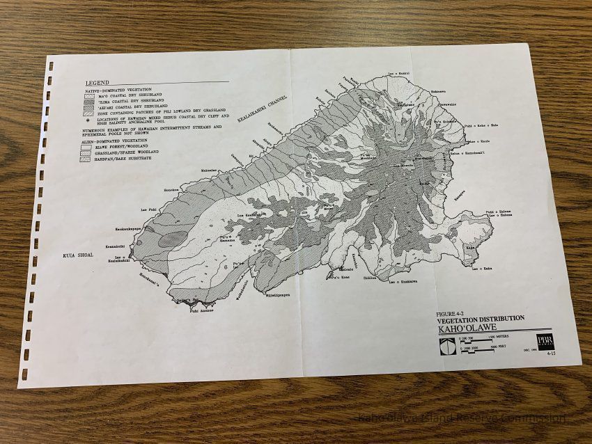
Map of vegetation distribution on Kahoolawe. Labeled Figure 4-2 of unknown publication. Shows native-dominated vegetation areas--mao, ilima, akiaki, pili lowland dry grassland & alien dominated vegetation areas-kiawe forest/woodland, grassland/sparse woodland, hardpan/bare substrate.Collection
KIRC AdministrationCataloged By
Gavagan,TerriLexicon
Nomenclature 4.0
Nomenclature Secondary Object Term
MapNomenclature Primary Object Term
CartographNomenclature Sub-Class
Graphic DocumentsNomenclature Class
Documentary ObjectsNomenclature Category
Category 08: Communication ObjectsLOC Thesaurus for Graphic Materials
MapsSearch Terms
Administrative Records, Flora, Maps, administrative records, maps, flora, FloraArchive Items Details
Title
Vegetation Distribution Kaho'olaweDescription
Map of vegetation distribution on Kahoolawe.Creator
PBR HawaiiDate(s) of Creation
Dec 1995Subjects
MapsSearch Terms
FloraNotes
Location: Storeroom
Container: Archive Drawer1Relationships
Related Places
Place
Ahupua'a
Kaho'olaweMoku
Honua'ulaMokupuni
Maui MokupuniState/Province
Hawai'iCountry
United States of America