Name/Title
Infrastructure Map Kaho'olaweEntry/Object ID
2011.019.34Scope and Content
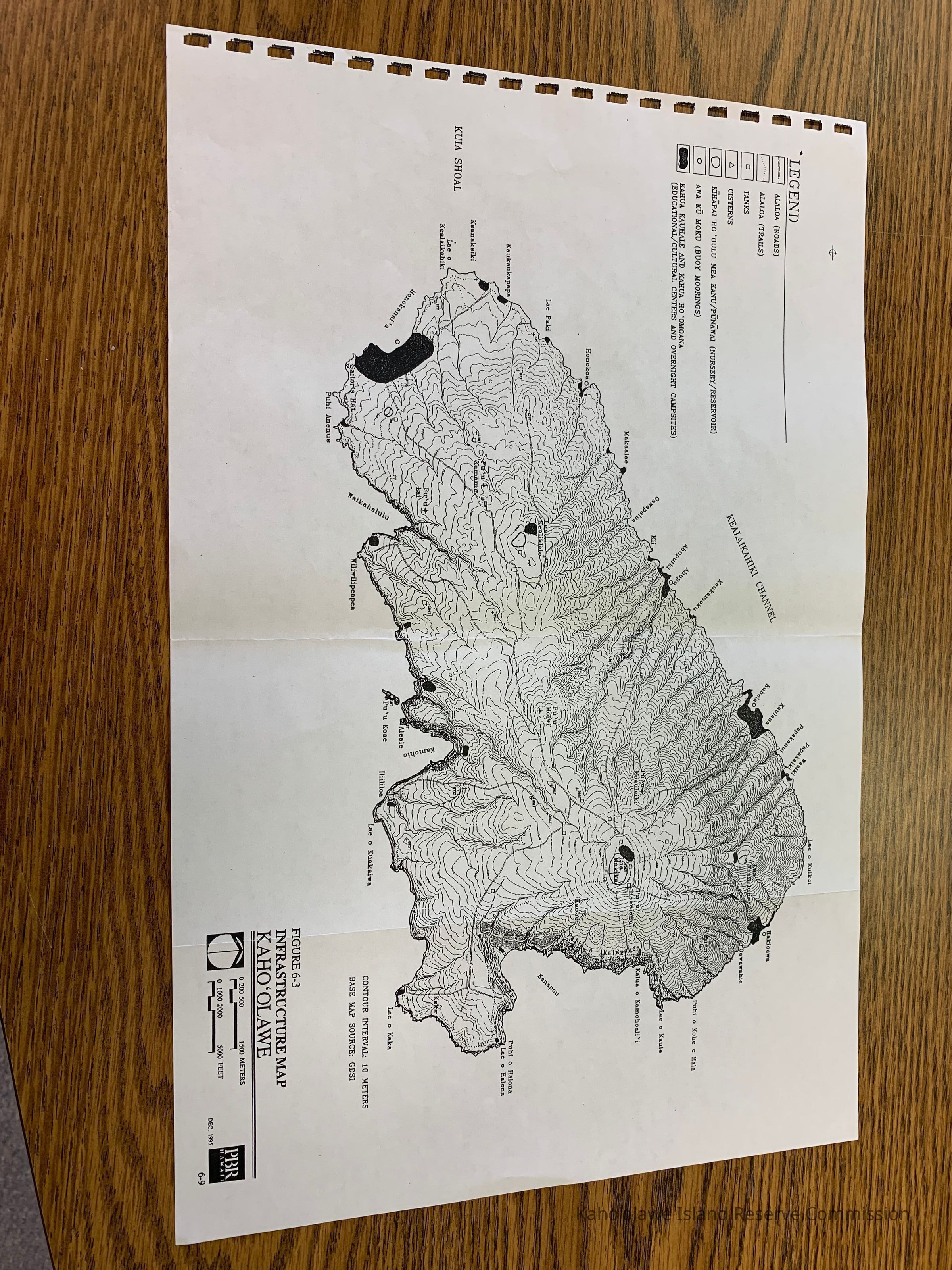
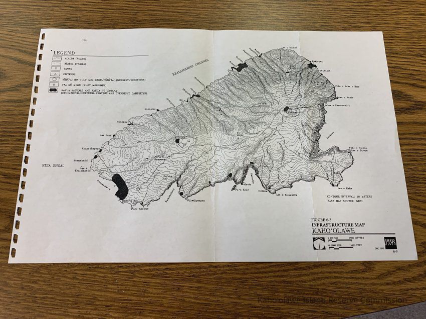
Map of the infrastructure on Kahoolawe. Labeled Figure 6-3 of unknown publication. Shows alaloa (roads and trails), tanks, cisterns, kihapai hooulu mea kanu/punawai (nursery/reservoir), awa ku moku (buoy moorings), kahu kauhale and kahua hoomoana (educational/cultural centers and overnight campsites).Collection
KIRC AdministrationCataloged By
Gavagan,TerriLexicon
Nomenclature 4.0
Nomenclature Secondary Object Term
MapNomenclature Primary Object Term
CartographNomenclature Sub-Class
Graphic DocumentsNomenclature Class
Documentary ObjectsNomenclature Category
Category 08: Communication ObjectsLOC Thesaurus for Graphic Materials
MapsSearch Terms
Administrative Records, Maps, administrative records, infrastructure, mapsArchive Items Details
Title
Infrastructure Map Kaho'olaweDescription
Infrastructure map of Kaho'olaweCreator
PBR HawaiiDate(s) of Creation
Dec 1995Subjects
MapsNotes
Location: Storeroom
Container: Archive Drawer 1Relationships
Related Places
Place
Ahupua'a
Kaho'olaweMoku
Honua'ulaMokupuni
Maui MokupuniState/Province
Hawai'iCountry
United States of America