Name/Title
Land Use Map Kaho'olaweEntry/Object ID
2011.019.35Scope and Content
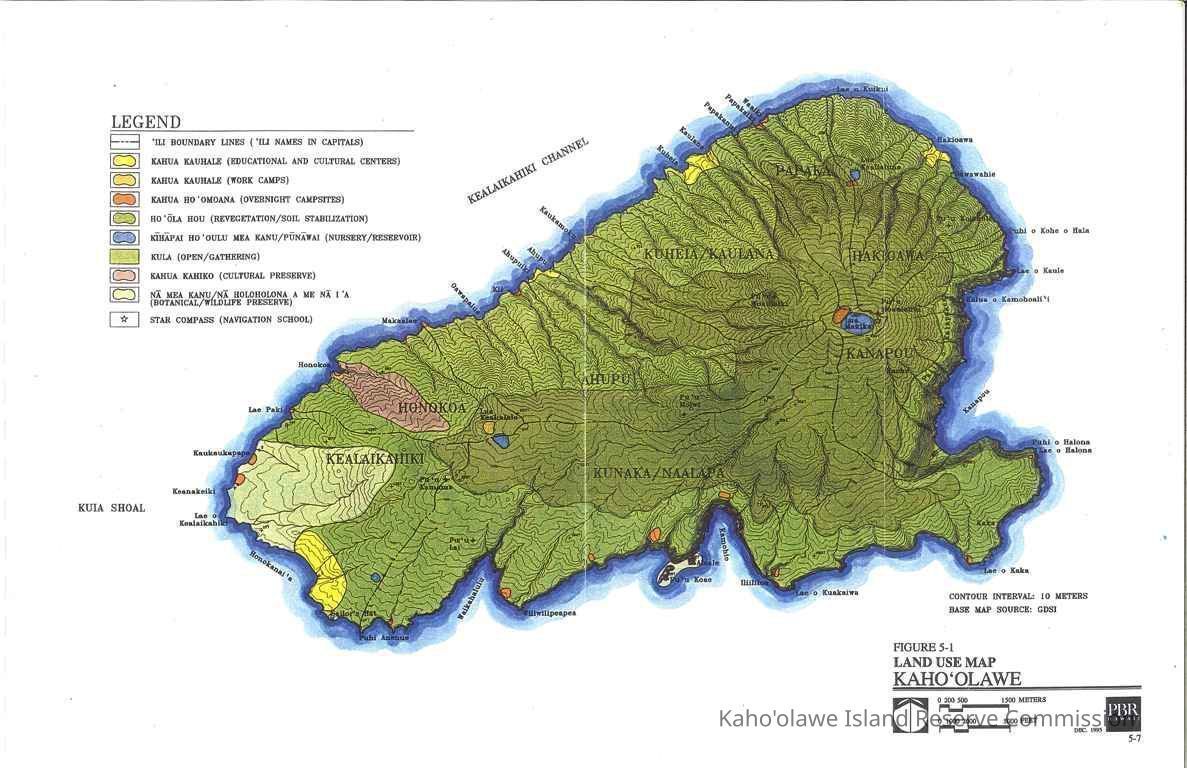
Color land use map of Kaho'olawe. Map is labeled Figure 5-1 for unknown publication. Map Source: GDSI Map shows: ili boundaries, kahua kauhale (educational & cultural centers, work camps), kahua hoomoana (overnight campsites), hoola hou (revegetation/soil stabilization), kihapai hooulu mea kanu (nursery), punawai (reservoir), kula (open/gathering), kahua kahiko (cultural preserve), na mea kanu (botantical preserve), na holoholona a me na ia (wildlife preserve), and star compass (navigation school).Collection
KIRC AdministrationCataloged By
Gavagan,TerriLexicon
Nomenclature 4.0
Nomenclature Secondary Object Term
MapNomenclature Primary Object Term
CartographNomenclature Sub-Class
Graphic DocumentsNomenclature Class
Documentary ObjectsNomenclature Category
Category 08: Communication ObjectsLOC Thesaurus for Graphic Materials
Administrative agencies, Land use, MapsSearch Terms
Administrative Records, Maps, administrative records, land use, mapsArchive Items Details
Title
Land Use Map Kaho'olaweDescription
Land use map of Kaho'olaweCreator
PBR HawaiiDate(s) of Creation
Dec 1995Subjects
Maps, Land useNotes
Location: Storeroom
Container: Archive Drawer 1Relationships
Related Places
Place
Ahupua'a
Kaho'olaweMoku
Honua'ulaMokupuni
Maui MokupuniState/Province
Hawai'iCountry
United States of America