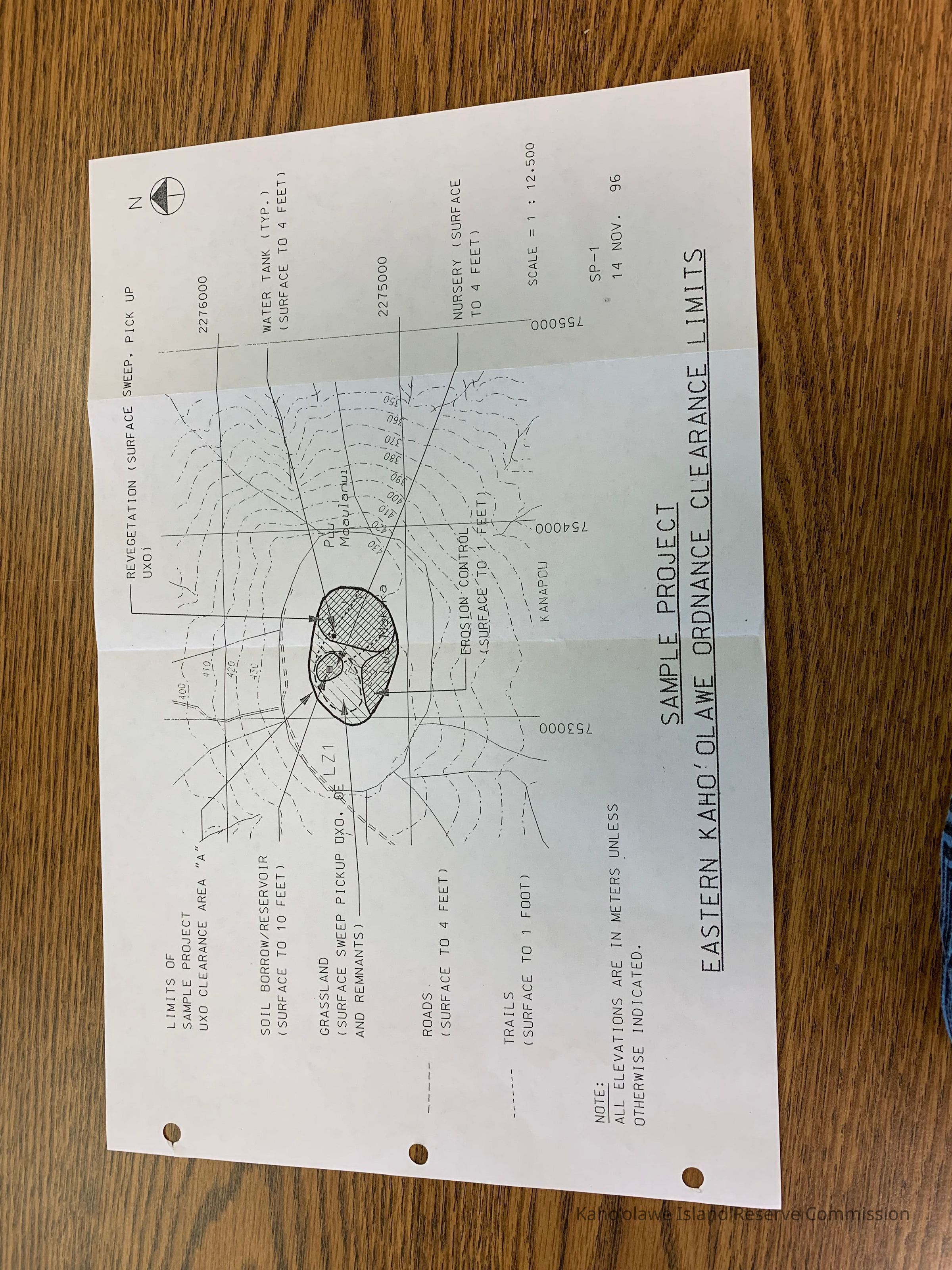
Name/Title
Sample Project, Eastern Kaho'olawe Ordnance Clearance LimitsEntry/Object ID
2011.019.53Description
Map of Sample Project, Eastern Kahoolawe Ordnance Clearance Limits. Map of Luamakika and location of grassland, tails, roads, erosion control and water tank.Collection
KIRC AdministrationCataloged By
Gavagan,TerriLexicon
Nomenclature 4.0
Nomenclature Secondary Object Term
MapNomenclature Primary Object Term
CartographNomenclature Sub-Class
Graphic DocumentsNomenclature Class
Documentary ObjectsNomenclature Category
Category 08: Communication ObjectsLOC Thesaurus for Graphic Materials
Administrative agencies, Maps, RoadsSearch Terms
administrative records, infrastructure, maps, military, operations, restoration, roads, UXO Clearance Project, environmentMap Details
Area or Region
Ahupua'a
Kaho'olaweMoku
Honua'ulaMokupuni
Maui MokupuniState/Province
Hawai'iCountry
United States of AmericaDate Published
Nov 14, 1996Medium
PaperPublication Language
EnglishDimensions
Width
11 inLength
17 inDimension Notes
11" x 17"Relationships
Related Places
Place
Ahupua'a
Kaho'olaweMoku
Honua'ulaMokupuni
Maui MokupuniState/Province
Hawai'iCountry
United States of America