Nomenclature 4.0
Nomenclature Secondary Object Term
MapNomenclature Primary Object Term
CartographNomenclature Sub-Class
Graphic DocumentsNomenclature Class
Documentary ObjectsNomenclature Category
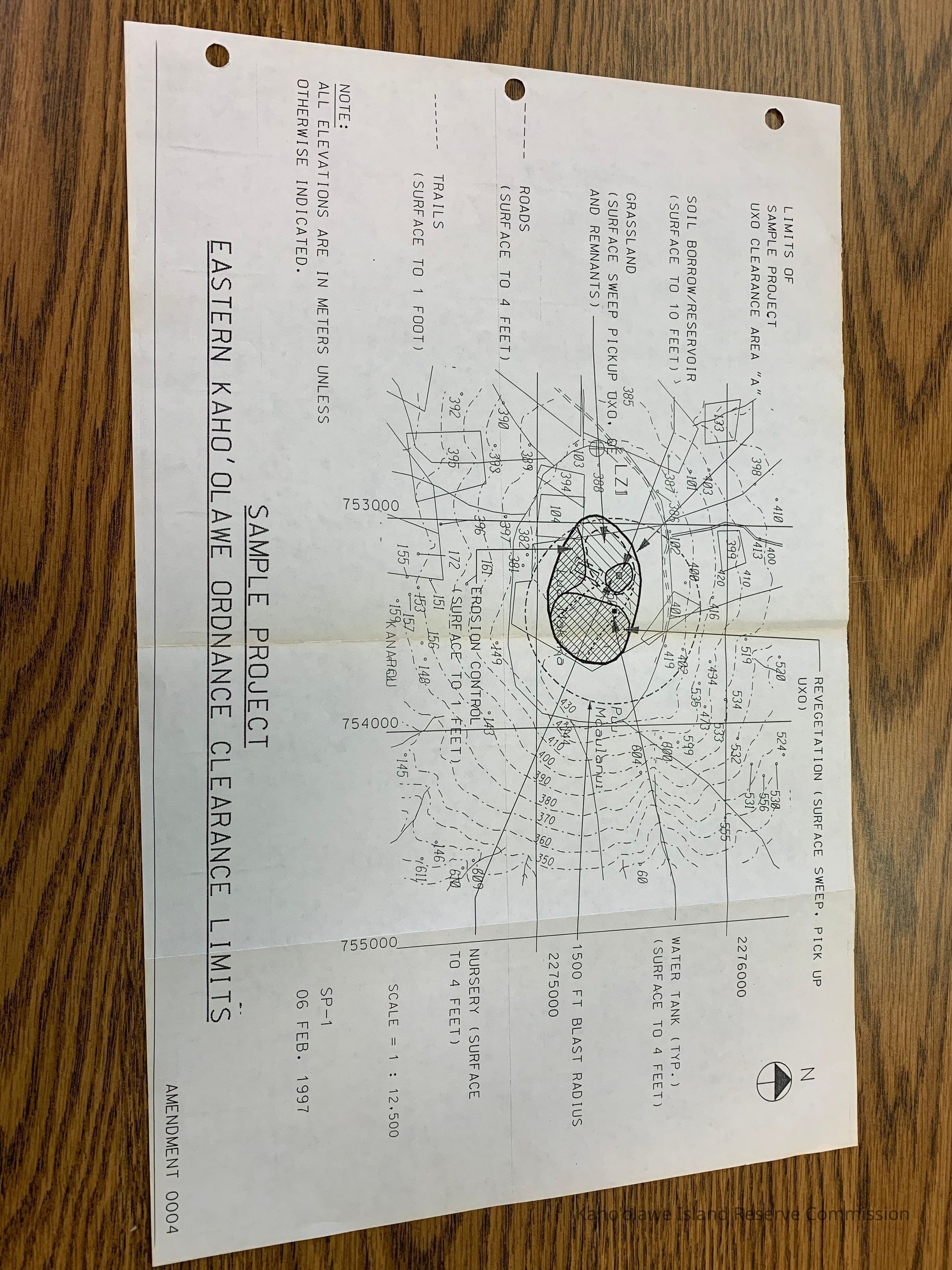
Category 08: Communication ObjectsLOC Thesaurus for Graphic Materials
Administrative agencies, Maps, RoadsSearch Terms
Administrative Records, Archaeology, Environment, Maps, Military, Restoration, administrative records, infrastructure, military, operations, restoration, roads, UXO Clearance Project, Environment, Military