The aerial image features a deep blue sea enclosed by rugged, towering cliffs, forming a natural cove with distinct striations visible along the cliff faces.
Name/Title
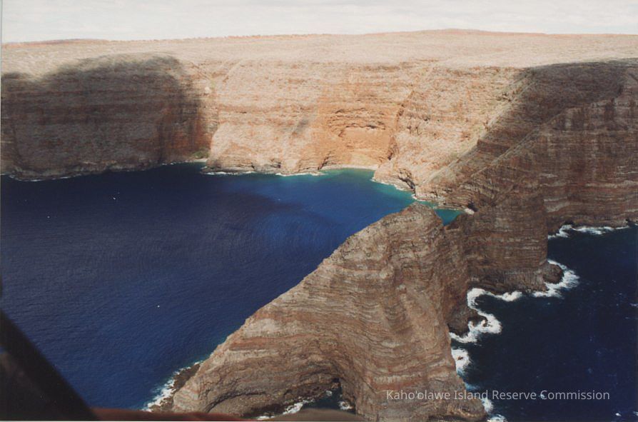
High aerial view of Pu'ukoa'e
Entry/Object ID
2010.001.246
Description
A high aerial of Pu'ukoa'e and nearby shorelines.
Photograph Details
Subject
Environment
Subject Place
Islet
Pu'ukoa'e
'Ili
Kūnaka/Na'alapa
Ahupua'a
Kaho'olawe
Moku
Honua'ula
Mokupuni
Maui Mokupuni
State/Province
Hawai'i
Country
United States of America
Collection
KIRC Administration
Cataloged By
Gavagan,Terri
Made/Created
Artist
Unknown
Studio
KIRC Ocean Resources Management Program (ORMP)
Date made
Jan 26, 2000
Notes
Frame Number: 9A
Medium: Photographic Paper
Photographic Process: Unknown
Lexicon
Nomenclature 4.0
Nomenclature Secondary Object Term
Photograph, Color
Nomenclature Primary Object Term
Photograph
Nomenclature Sub-Class
Graphic Documents
Nomenclature Class
Documentary Objects
Nomenclature Category
Category 08: Communication Objects
LOC Thesaurus for Graphic Materials
Aerial photographs, Aerial views, Coastlines
Search Terms
Ocean Resources Management Program (ORMP), ORMP, Environment
Other Names and Numbers
Other Numbers
Number Type
Other Number
Other Number
PA96.1/118.b
Dimensions
Height
4 in
Width
6 in
Relationships
Related Places
Place
Islet
Pu'ukoa'e
'Ili
Kūnaka/Na'alapa
Ahupua'a
Kaho'olawe
Moku
Honua'ula
Mokupuni
Maui Mokupuni
State/Province
Hawai'i
Country
United States of America
Related Publications
Notes
[\\KIRC-LIB-01\Library Database\KICC Reports\16 Place Names of Kaho'olawe.pdf] contains information about this area.
[\\KIRC-LIB-01\Library Database\KICC Reports\17_Na_Wahi_Pana_O_Kahoolawe_acc.pdf] contains information about this area.