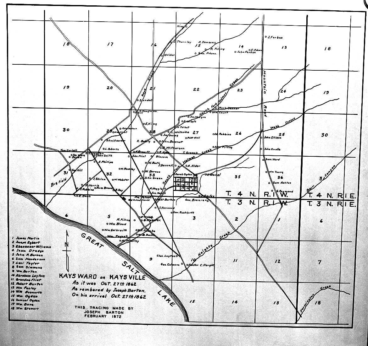
Name/Title
1872 Map of KaysvilleEntry/Object ID
2023.1.200Scope and Content
Map tracing of Kaysville.Context
Tracing made by Joseph Barton in February 1872 of Kay's Ward or Kaysville as it was remembered by him on his arrival on October 27, 1862Collection
Robert Anderson CollectionLexicon
LOC Thesaurus for Graphic Materials
Maps, Lakes & ponds, Tracings, Canyons, Creeks, Mountains, RoadsDimensions
Dimension Description
Content Type"image/jpeg"
Content Length"341 KB (349161 bytes)"
Dimensions"1170 X 1102"; 130 dpiDimension Notes
Scanned by original ownerCopyright
Copyright Holder
Kaysville-Fruit Heights Museum of History and ArtRestrictions
The public is granted reproduction rights only for limited non-profit, and personal or educational purposes with attribution or citation.