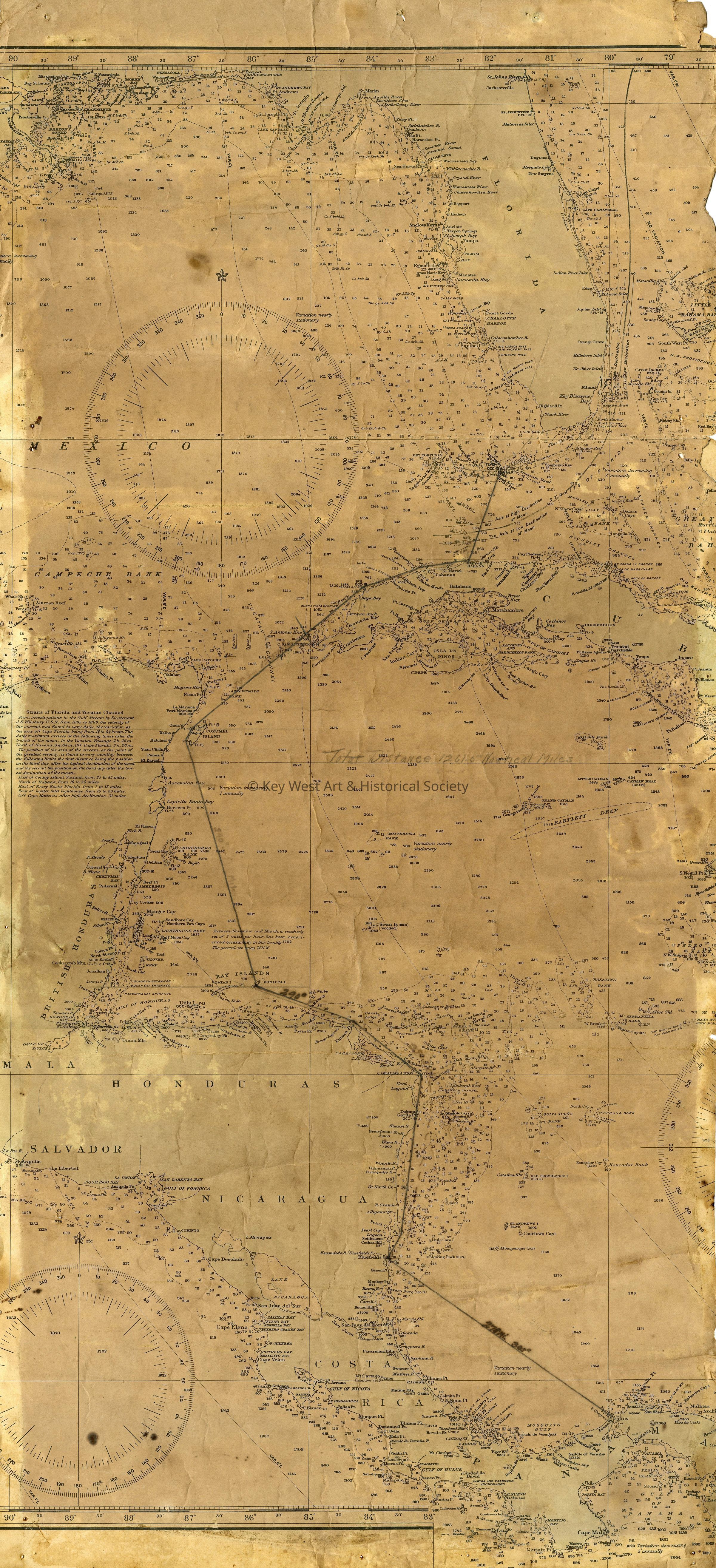
Navigational Chart of Western Caribbean and Florida
Entry/Object ID
1987.01.1267a
Scope and Content
Section of a nautical chart of the western Caribbean and Florida belonging to Dr. Thomas Osgood Otto detailing the route of his 1919 flight from Panama to Key West via Bluefields and Cuba.