Name/Title
Dutch Map of Florida and the West IndiesEntry/Object ID
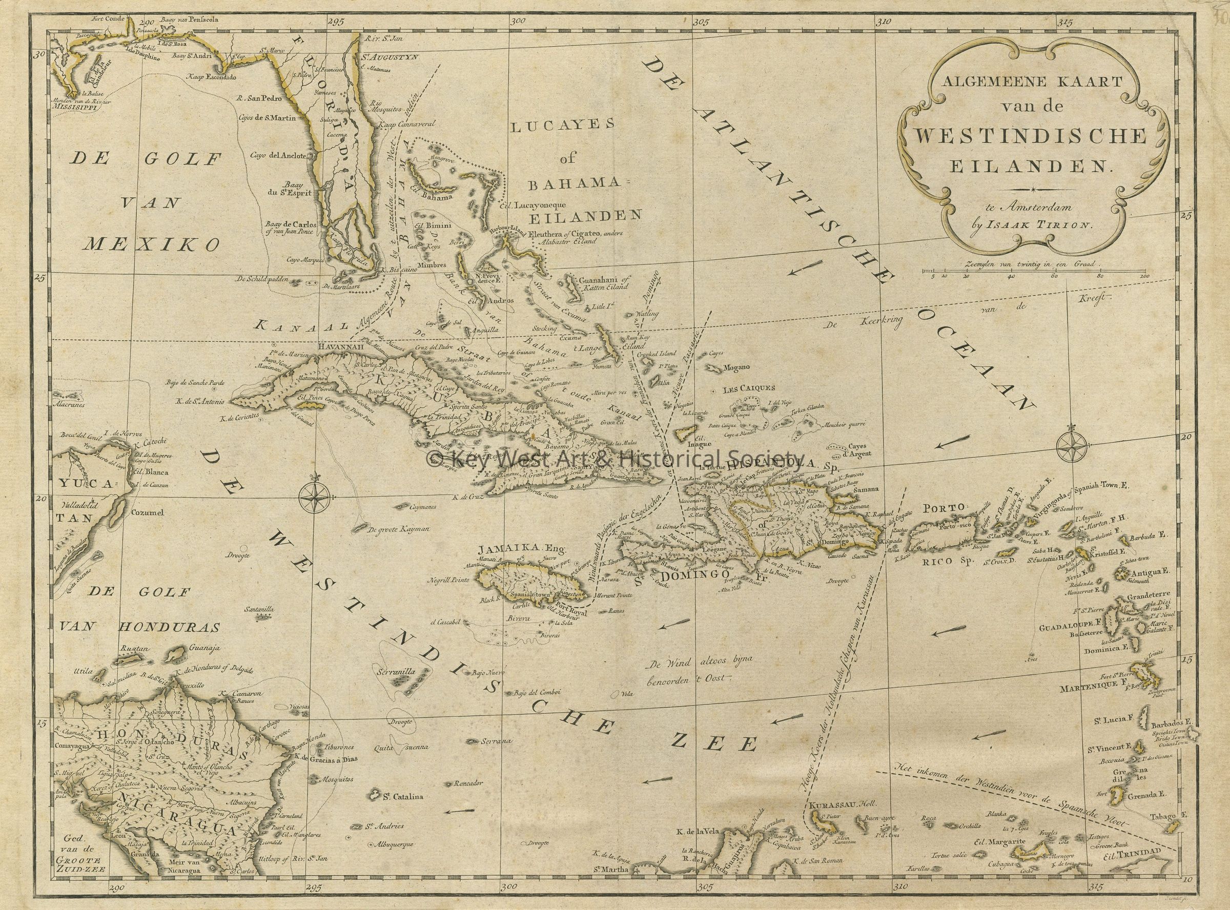
1987.01.1301Description
Dutch printed map of Florida, Cuba and the West Indies. There is an inclusion of trade routes around the Caribbean along with highly-detailed notations of locations throughout including Cuba, Hispaniola, Puerto Rico, the Bahamas, the Virgin Islands, Martinique, Guadeloupe, Antigua, Barbuda, St. Lucia and Curacao. The Florida Keys are labelled 'De Martelaars' which translates from Dutch as 'The Martyrs'.Collection
Artifact CollectionMade/Created
Artist Information
Artist
Tirion, IsaakRole
ArtistDate made
1769Time Period
18th CenturyPlace
City
AmsterdamCountry
NetherlandsRegion
Western EuropeContinent
EuropeLexicon
Nomenclature 4.0
Nomenclature Secondary Object Term
MapNomenclature Primary Object Term
CartographNomenclature Sub-Class
Graphic DocumentsNomenclature Class
Documentary ObjectsNomenclature Category
Category 08: Communication ObjectsDimensions
Height
14-1/4 inWidth
19 inCondition
Reason for Exam
InventoryOverall Condition
Good